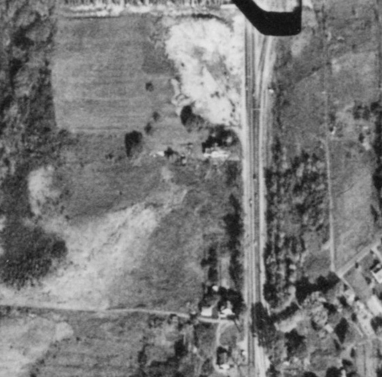
Bear Trap Park
The structures just below the white circular area (former site of Morey's Park and Dreamwyld) are proposed as the site of Bear Trap Park. It fits the description because it is near Morey's, it can't be north of Morey's Park because that land was developed and belong to the Morley family. The path of Bear Trap Creek runs diagonally across the photo. It runs from the northeast, passing through the present location of Northern Lights, runs by Bear Trap Park and continues to the southwest.
This identification is not 100% certain. Bear Trap Park might have been located in the white circular area just south of Dreamwyld. Coming in from the south was the old Baum Spring farm that had been owned by Baum, Crouse, Matty, Michels, Cook and then others after Cook who have not been found yet.
The lower left hand corner of the photo is the present location of KMart Palza. Also near the bottom of the photo, Sand Road goes off diagonally from Brewerton Road and heads northeast.
|
Date |
Event |
|
8/17/32 |
1st Ward Republican Annual Clambake |
|
9/18/32 |
4th Ward Republican Club annual outing |
|
10/2/33 |
4th Ward Republican Club Clambake |
|
10/16/33 |
Late season clambake due to warm temperatures |
|
8/15/38 |
City Wide Social Club Picnic |
|
8/28/38 |
6th Ward GOP Picnic |
|
7/17/41 |
27th Div - End of furlough picnic at Bear Trap Park |
|
6/26/42 |
Mattydale School Mothers’ Club - yearly picnic |
|
8/3/42 |
The congregation of St. Elias Syrian Orthodox Church held its13th annual outing |
These represent a sampling of the appearances of Bear Trap Park or Bear Trap Creek Park in the local newspapers. There were many more announcements concerning this park, in the papers, but none were found prior to Aug 17, 1932 or after Aug 3, 1942. The directions to Bear Trap Park were that it was "near to Morey's."
It wasn't found on the 1927 Residential Development Maps of the area.