|
Aerial Mattydale |

|
Aerial Mattydale |
|||
|
Introduction Through good fortune and a bit of luck, four sets of old aerial photos have been found that cover all or parts of Mattydale. These are from 1926, 1938, 1951 and 1966. The 1926 set of photos were from a project that photographed the city of Syracuse and Mattydale just made it onto the ragged edge of the northern most photos. Mattydale is covered only up to the Kirsch farm on Brewerton Road. The photos in the 1926 set are not in the best of shape and the word ragged is to be taken literally. In 1938, Mattydale suffered from a non uniform distribution of the imaging points. Only the far eastern portion of Mattydale made it into the photos of the 1938 set. All of Mattydale made it into the 1951 and 1966 photo sets.
|
|||
|
Aerial Analysis Features in Mattydale (A) 1926 - Brewerton & Molloy Up to Kirsch Compound (B) 1926 - Brookfield to St Margaret’s Church location (Church built in 1929) (C) 1951 - Brewerton & Molloy |
|||
 |
|||
|
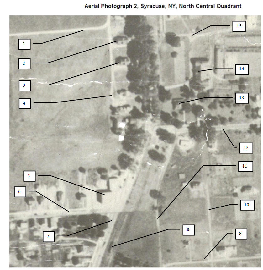
There are many landmarks that can be seen in this 1926 picture. Toward the bottom center is the intersection of Brewerton Road (lined with Elm trees) and Molloy Road entering from the right. To the left of Brewerton Road are three houses in a row, contained in the black ellipse. These three were owned by members of the Kirsch family. The first one has recently been removed, in some manner but the third house is the home of Cam-Nel’s Restaurant. In the north east corner of the Brewerton and Molloy Road intersection is the farm of Frank Matty. Matty’s house is set back a little from both roads, right at the intersection. Just northeast of the house was Frank Matty’s famous double barn. The northern edge of the double barn can be seen to just about line up with Cam-Nel’s.
Frank Matty opened part of his farm for residential development in 1922. There were three streets: Matty, Earl and Beley and some of the lots can be seen to contain houses but the settlement is sparse. The roads of Matty’s development don’t seem to be very well defined.
Up at the top of the picture is part of the Kirsch compound. The long barn, extending east and west is probably the fairly new barn that burned in August 1927. |
|||
|
Aerial Photograph 2 (Syr26-2), Syracuse, NY, North Central Quadrant, Airmap of City of Syracuse, Charles H. Hanna, Mayor; Nelson F. Pitts, Jr., City Engineer; Made by Airmap Corporation of America, Brooklyn, NY, November 1926. Contributor - Digital Imaging Services Center, Syracuse University Library
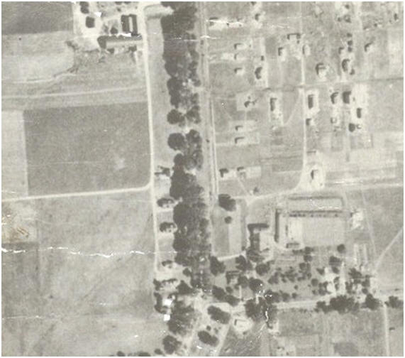
The labeling of the Kirsch houses on Brewerton Road, as shown in the aerial photo above, have been selected in anticipation of the house that was subsequently built between the two shown here. In the 1930 census the occupancy was, starting from the north: (1) Leo Kirsch, (2) Henry Kirsch, and (3) Emmanuel Kirsch. In 1925 only Leo and Emmanuel were living on Brewerton Road, Henry was living in the 1st Ward.
|
|||
|
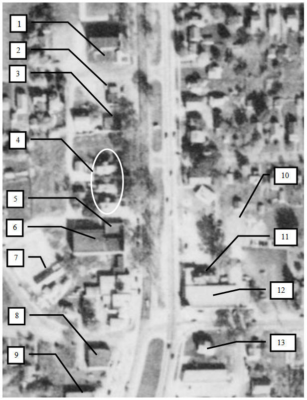
October 1951 - Aerial photo of the intersection of Brewerton and Molloy Roads.
|
|||
|
|