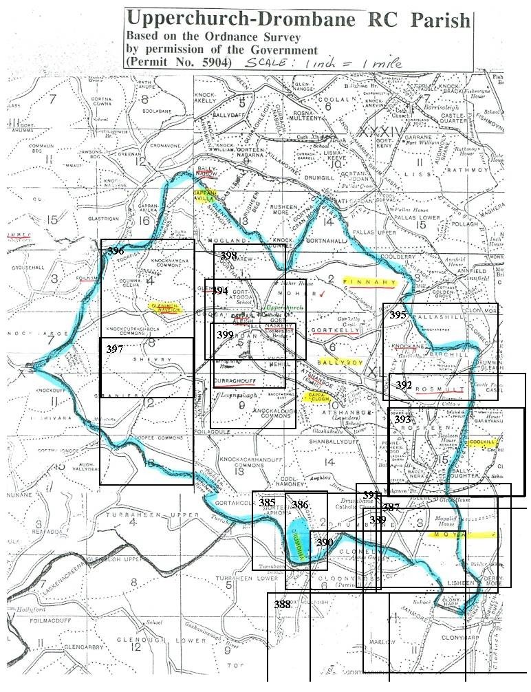
Map Guide
The numbered rectangles shown on the map below correspond to the Ordnance Survey Maps on the Upperchurch Maps page. Click on the number in the upper left hand corner of the rectangle and the corresponding Ordnance Survey map will open.
NOTE The map used for this guide is not a great map. Although it works as a guide to the more accurate maps it has several limitations: (1) it was pieced together from several maps; (2) the grid which should be square is rectangular which points to distortion from copying and scanning - therefore the scale "1 inch = 1 mile" is not to be taken seriously; (3) the border of the Upperchurch-Drombane RC boundary is not accurate. The Upperchurch-Drombane RC parish includes the civil parishes of Upperchurch, Templebeg and Moyaliff. There are townlands shown in the northwest and southeast sections that should be included within the boundary of the RC parish; (4) on the northwest and southeast borders of the maps there are townlands from the civil parishes of Upperchurch and Moyaliff that are missing from the map and these should also be included with the RC parish boundary.
Copyright © 2006 - Michael F. McGraw
|
Upperchurch Connections |
What's New? |
|||
|
|
||||
 |
||||