Upperchurch Area Maps
Surveyed in 1840-41 by Major Waters and Lieutenants Fenwick and Stace R.E. Engraved 1843 under the direction of Captain Larcom R.E. at the Ordnance Survey Office, Phoenix Park by John O'Neill, the ornament by George Waller, the writing by John Ainslie.
Colonel
Colby F.R.S.L.&E. - M.R.I.A. & Superintendent.
![]()
Six inches to 1 statute mile - Plates 40 & 46
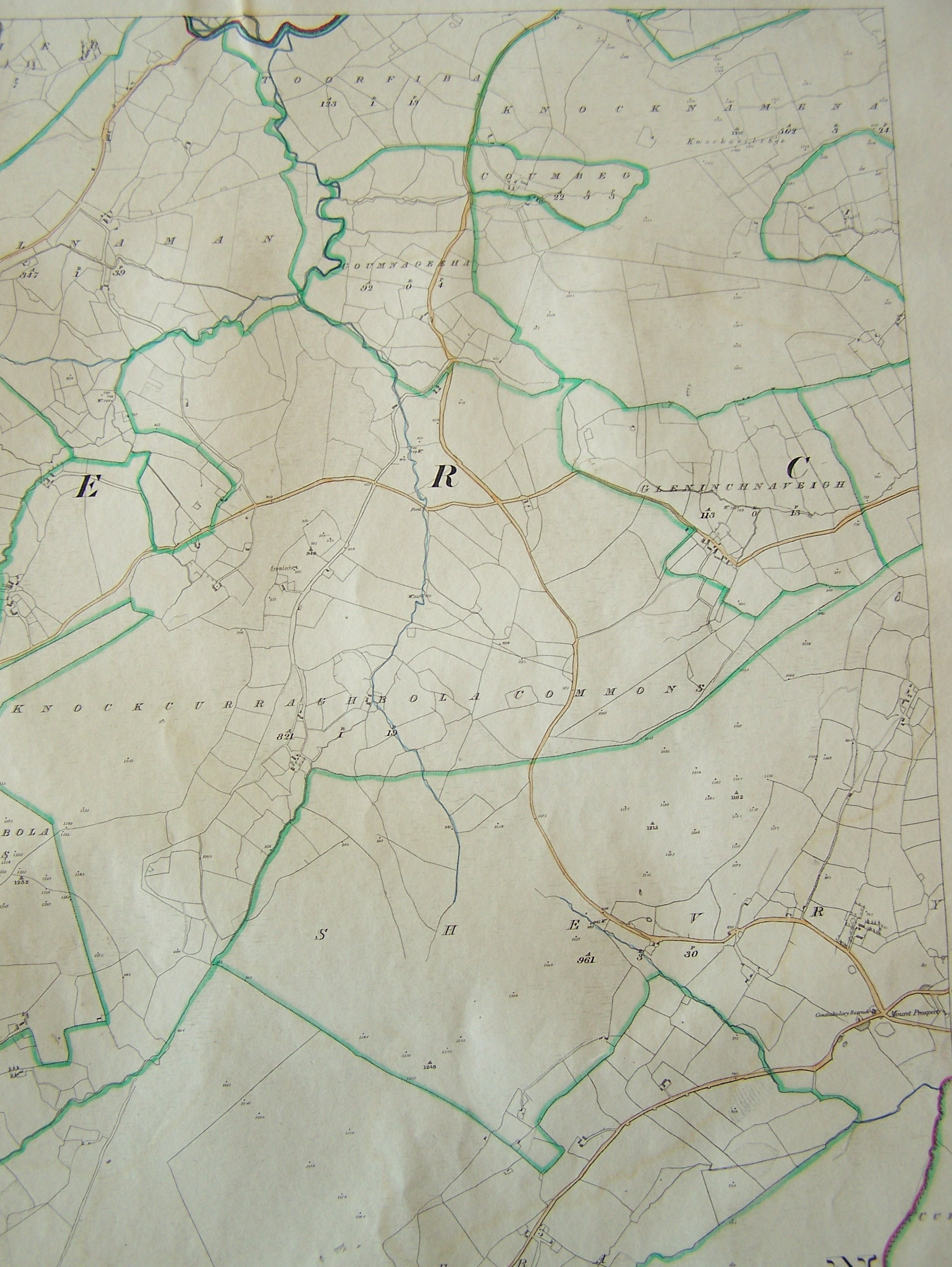
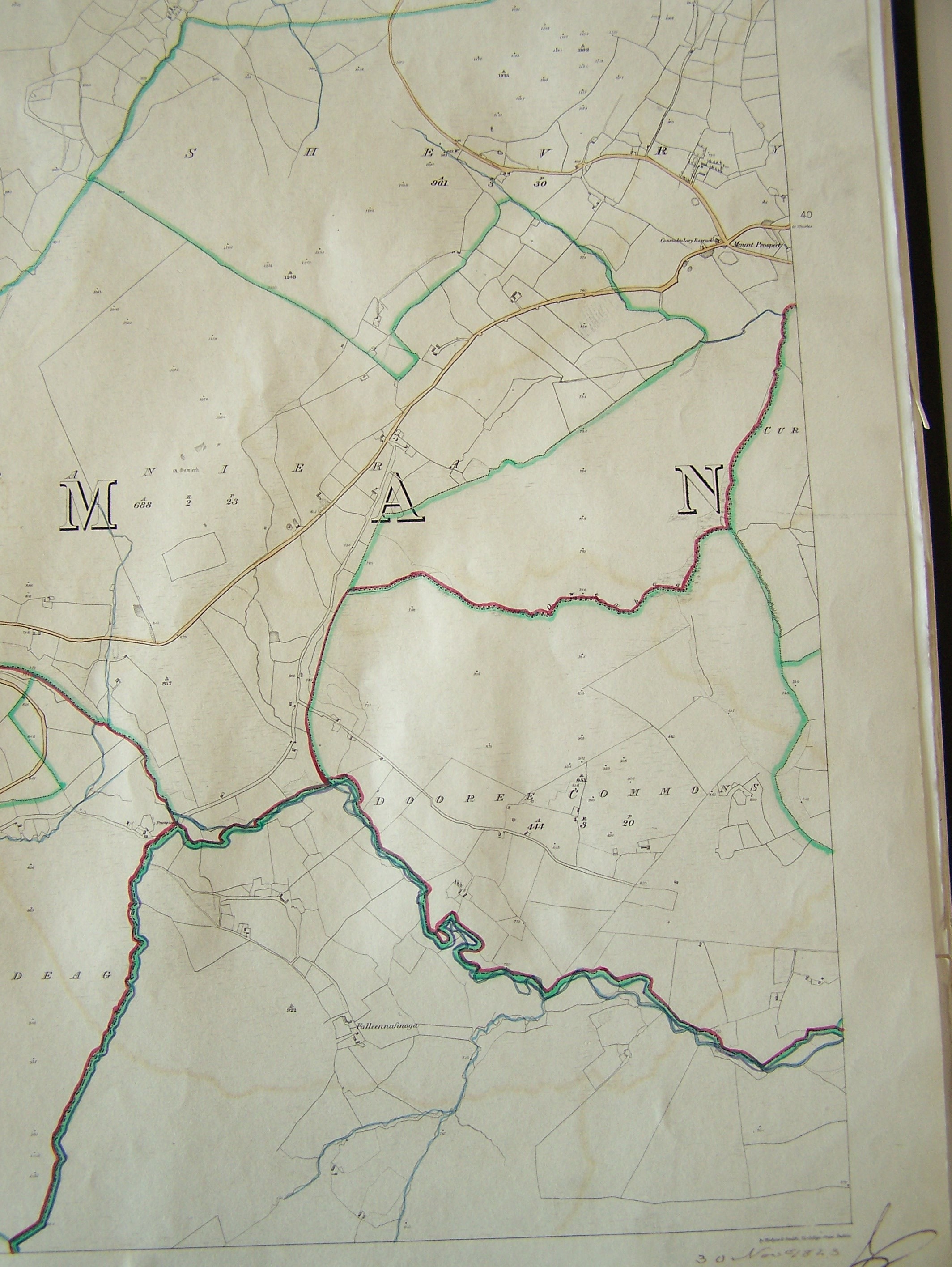
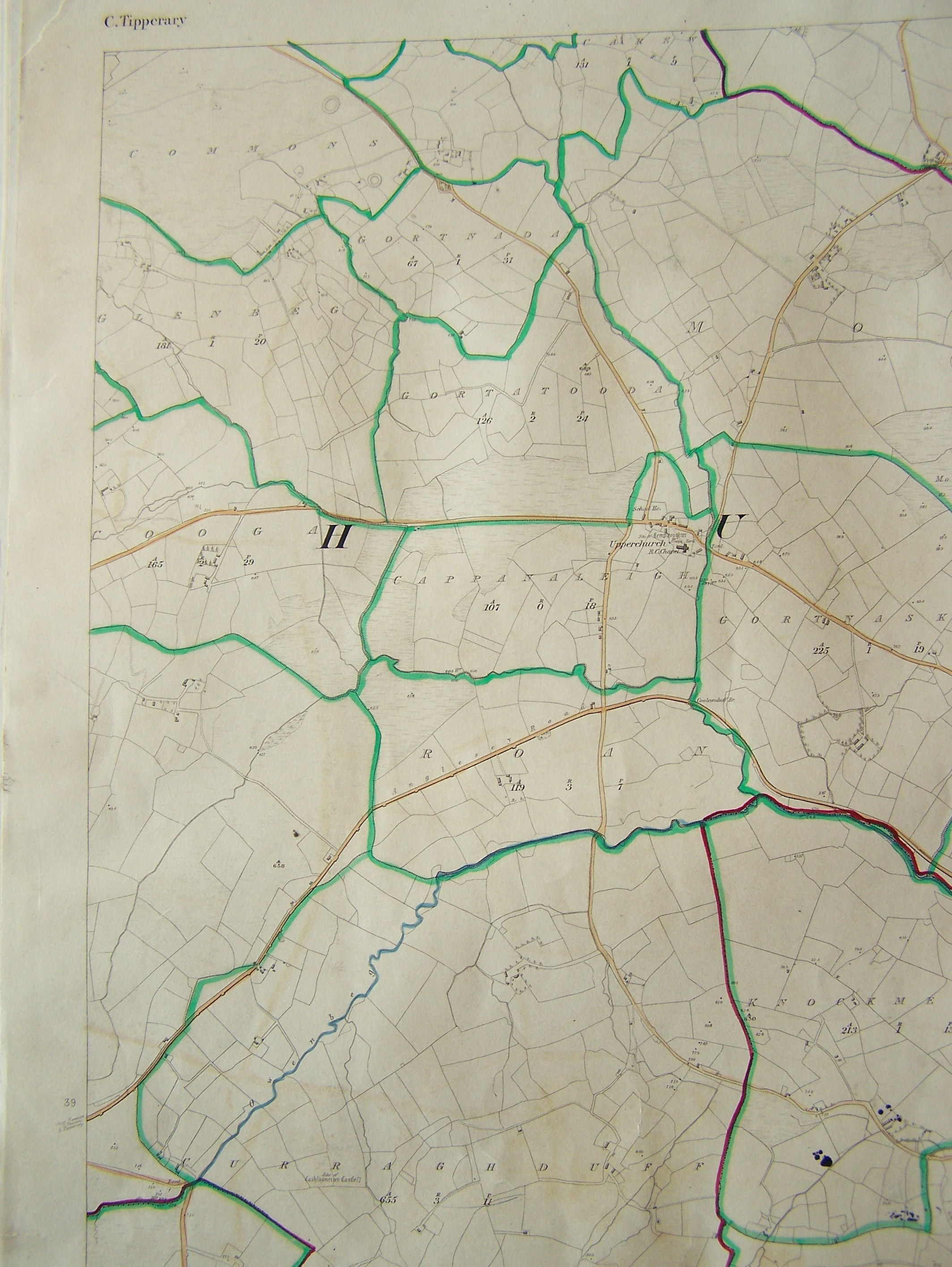
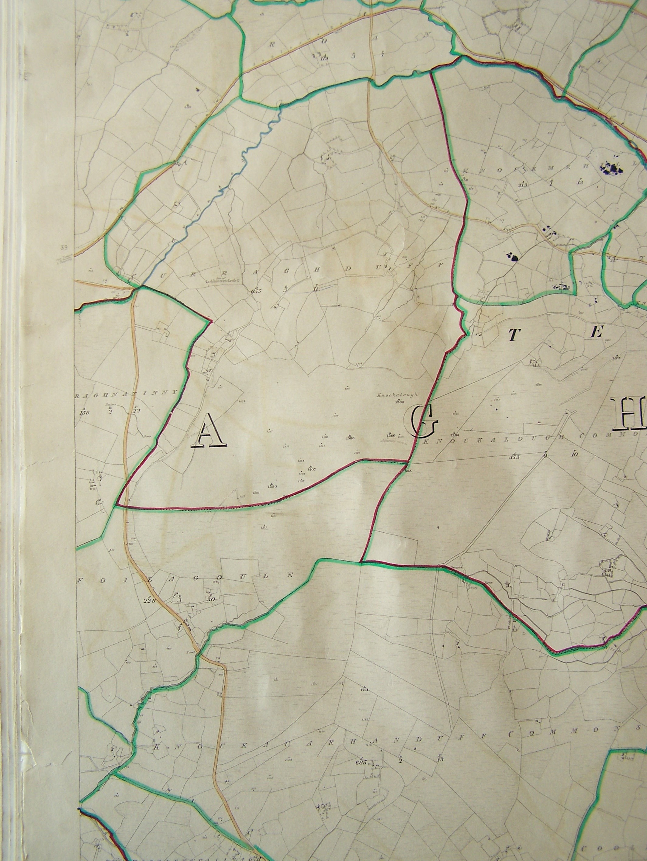
Note: These digital pictures do not cover all of the Upperchurch-Drumbane R.C. Parish. The areas of interest were the locations of ancestral cottages and the graveyard locations that were to be visited. The quality varies due to the newness of the camera and my experimentation with different camera settings. Given more time the quality and coverage would have been better. In the interest of providing information that is not readily available outside of Ireland I have uploaded all of the map images taken that day. The numbers designating the various maps on this page and on the Map Guide refer to the file names of the JPEG images of these maps and have nothing to do with the actual Ordnance Survey Maps.
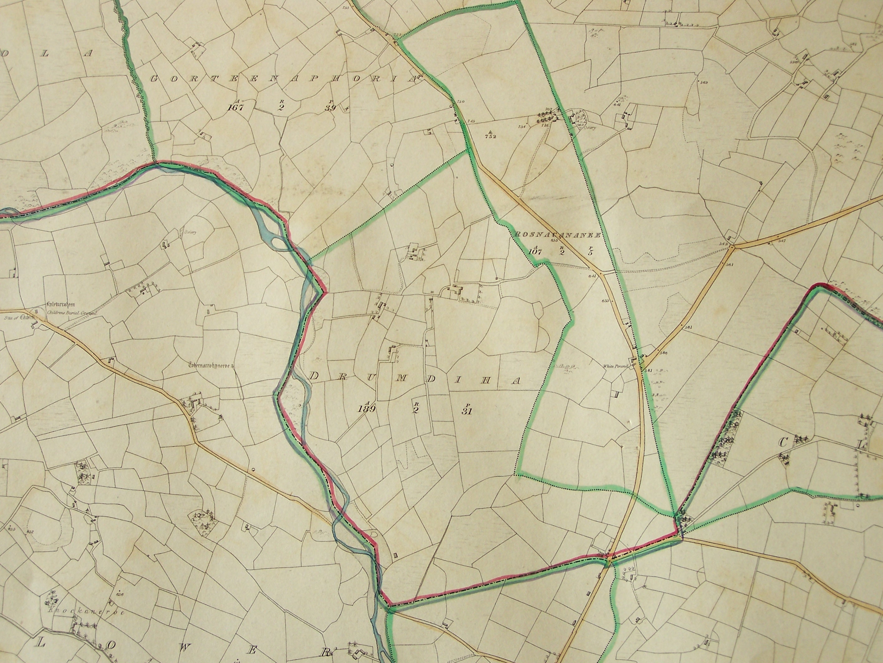 |
Map 385. In Moyaliff - Drumdiha (189-2-31) in center Rosnacananee (107-2-5), Gorteenaphoria (167-2-39) |
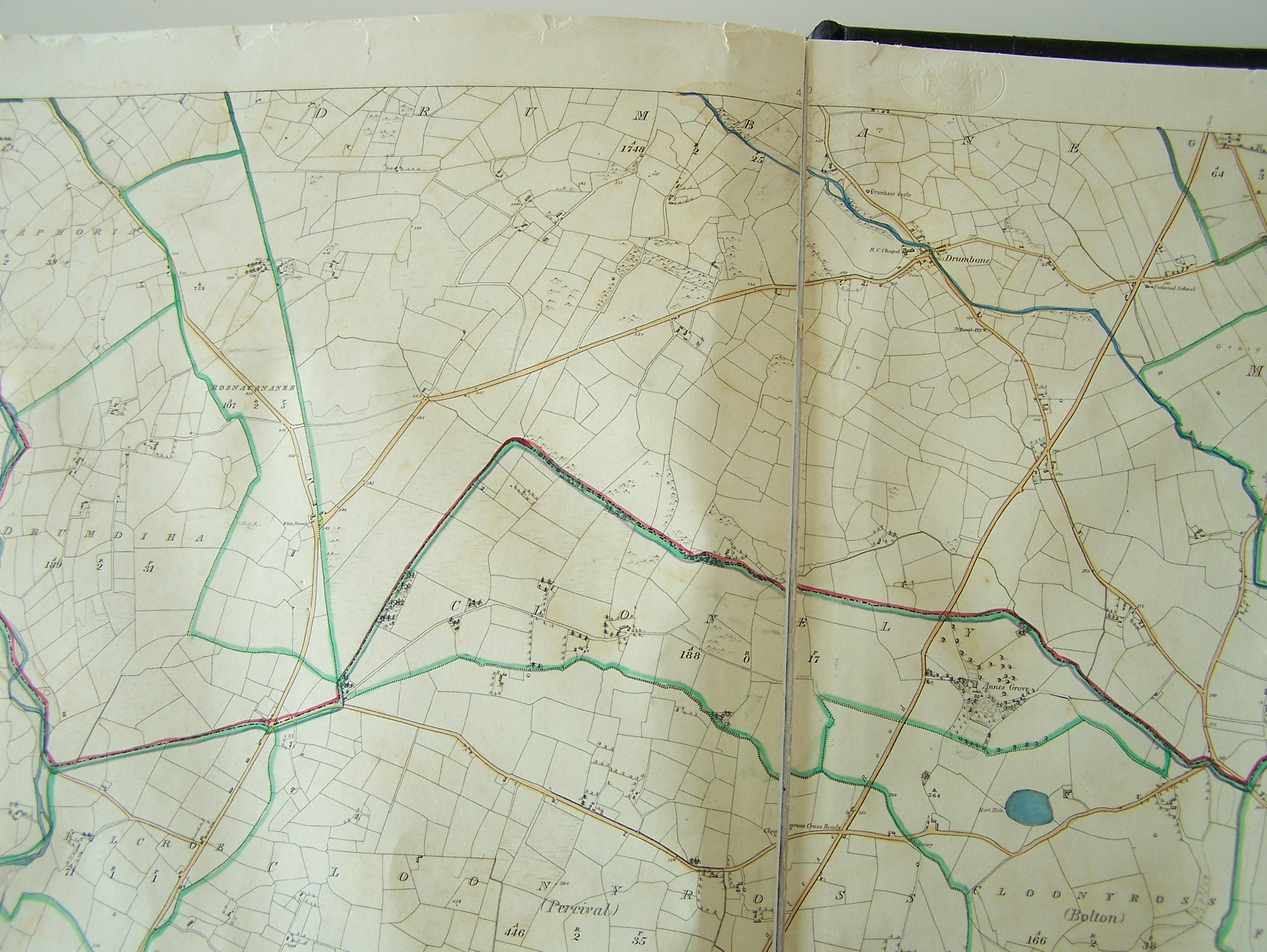 |
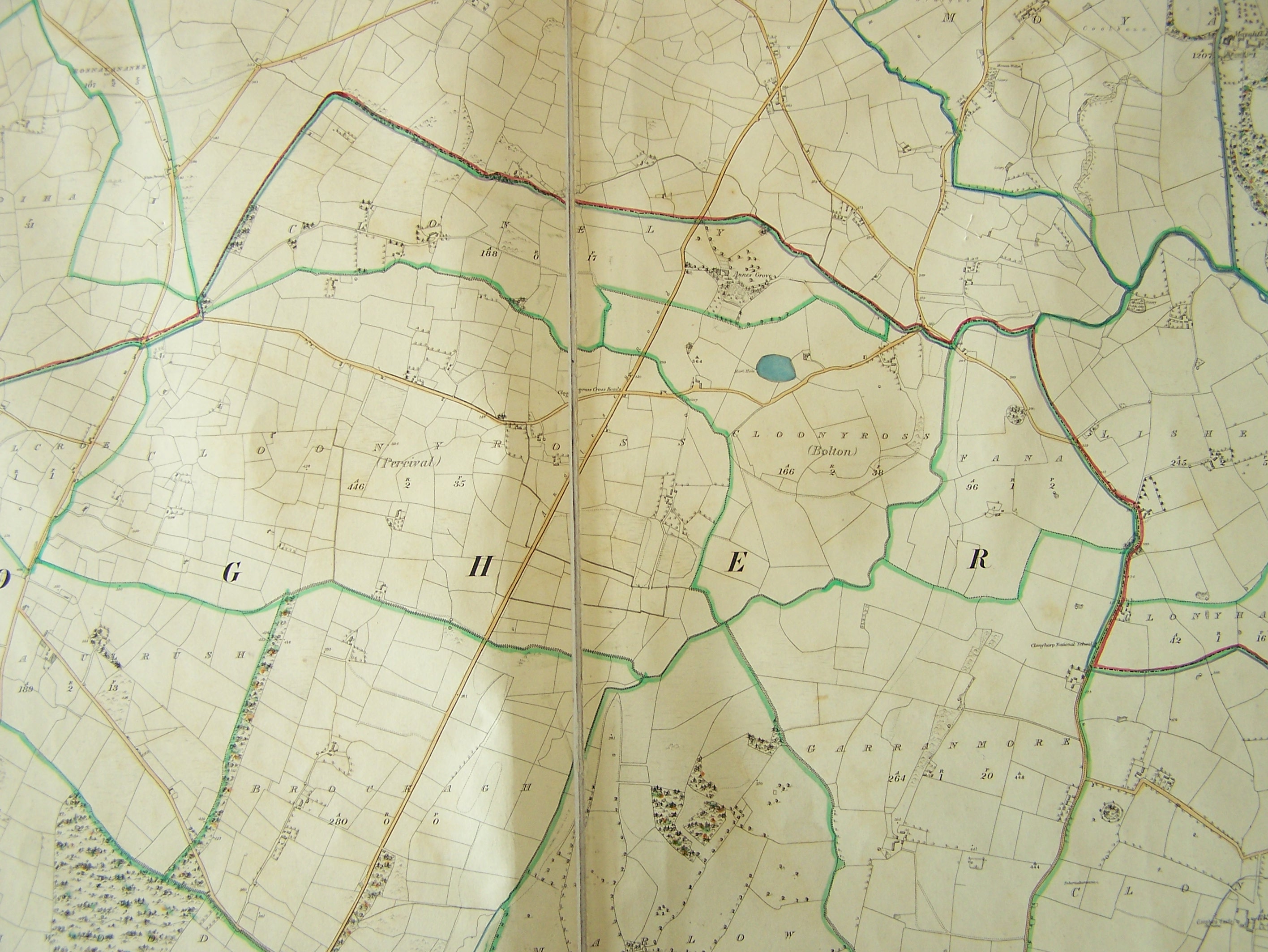
Map 386. In Moyaliff - Drumbane (1748-2-25), Drumdiha (189-2-31), Rosnacananee (107-2-5), part of Gorteenaphoria (167-2-39). In Clogher - Clonely (188-0-17), part of Clooneyross (Percival) (446-2-35), part of Clooneyross (Bolton) (166-2-38) |
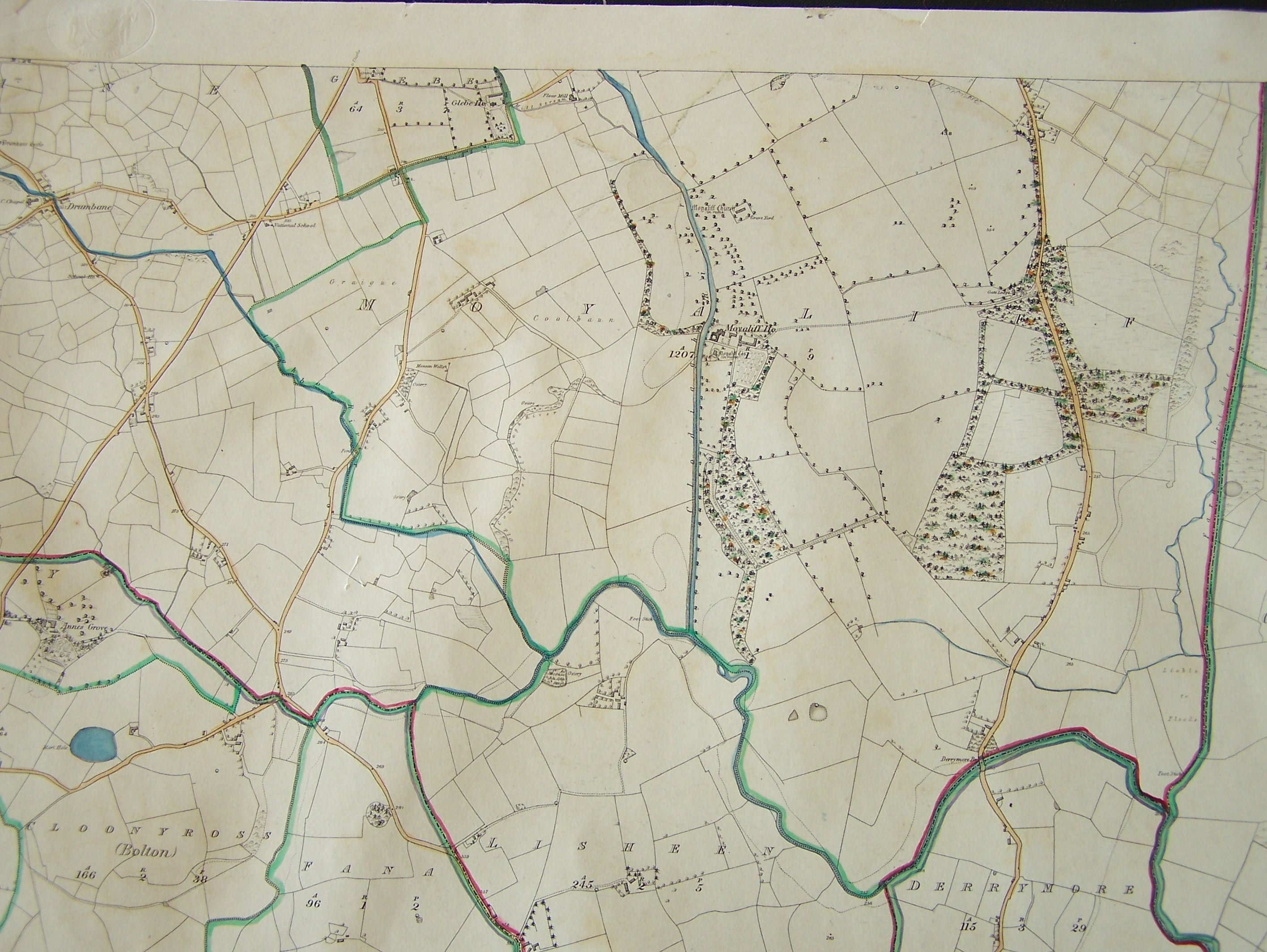 |
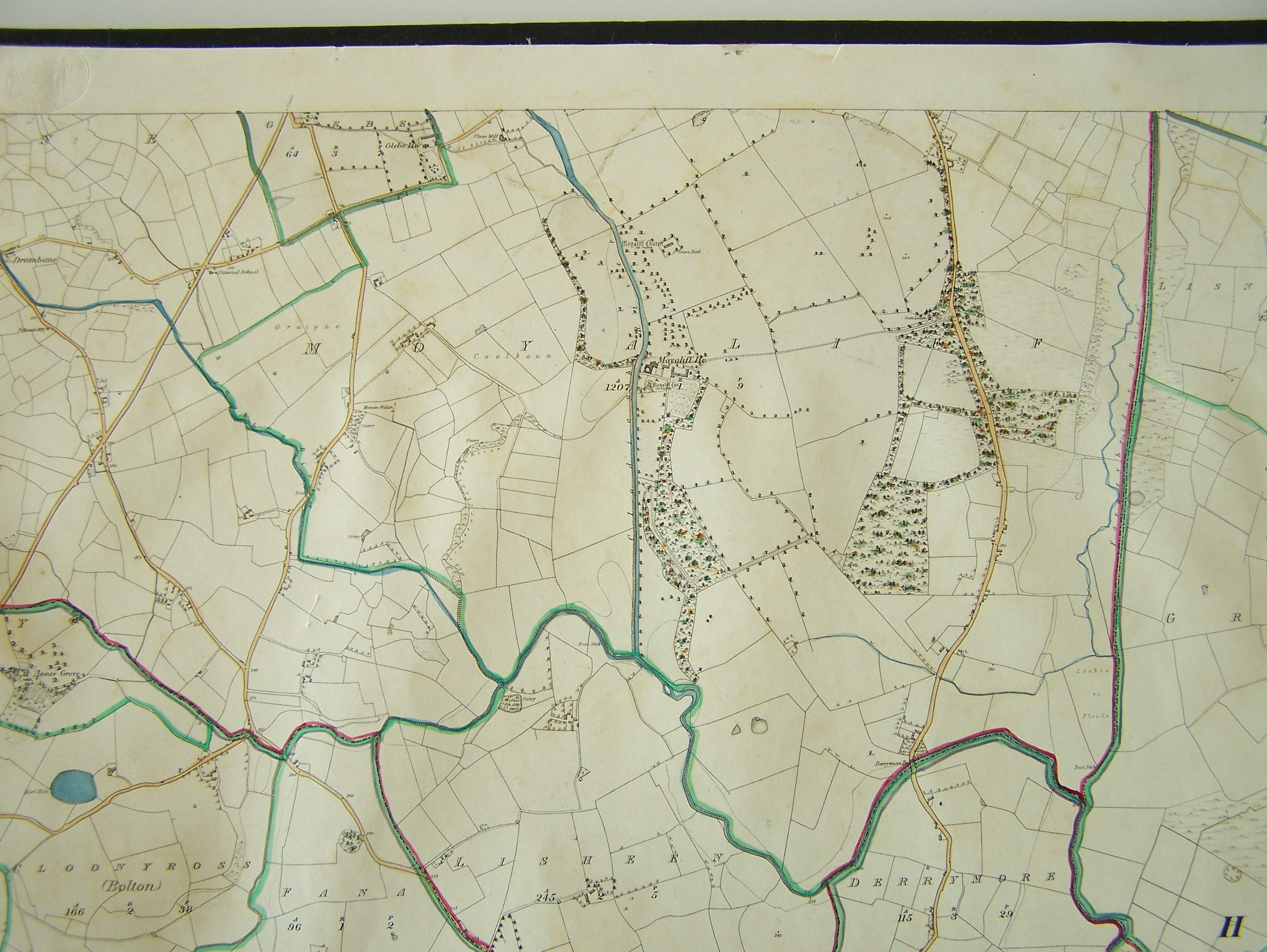
Map 387. In Moyaliff - Part of Drumbane, Glebe, Moyaliff, In Clogher - part of Derrymore, part of Lisheen, part of Clooneyross (Bolton), part of Fana |
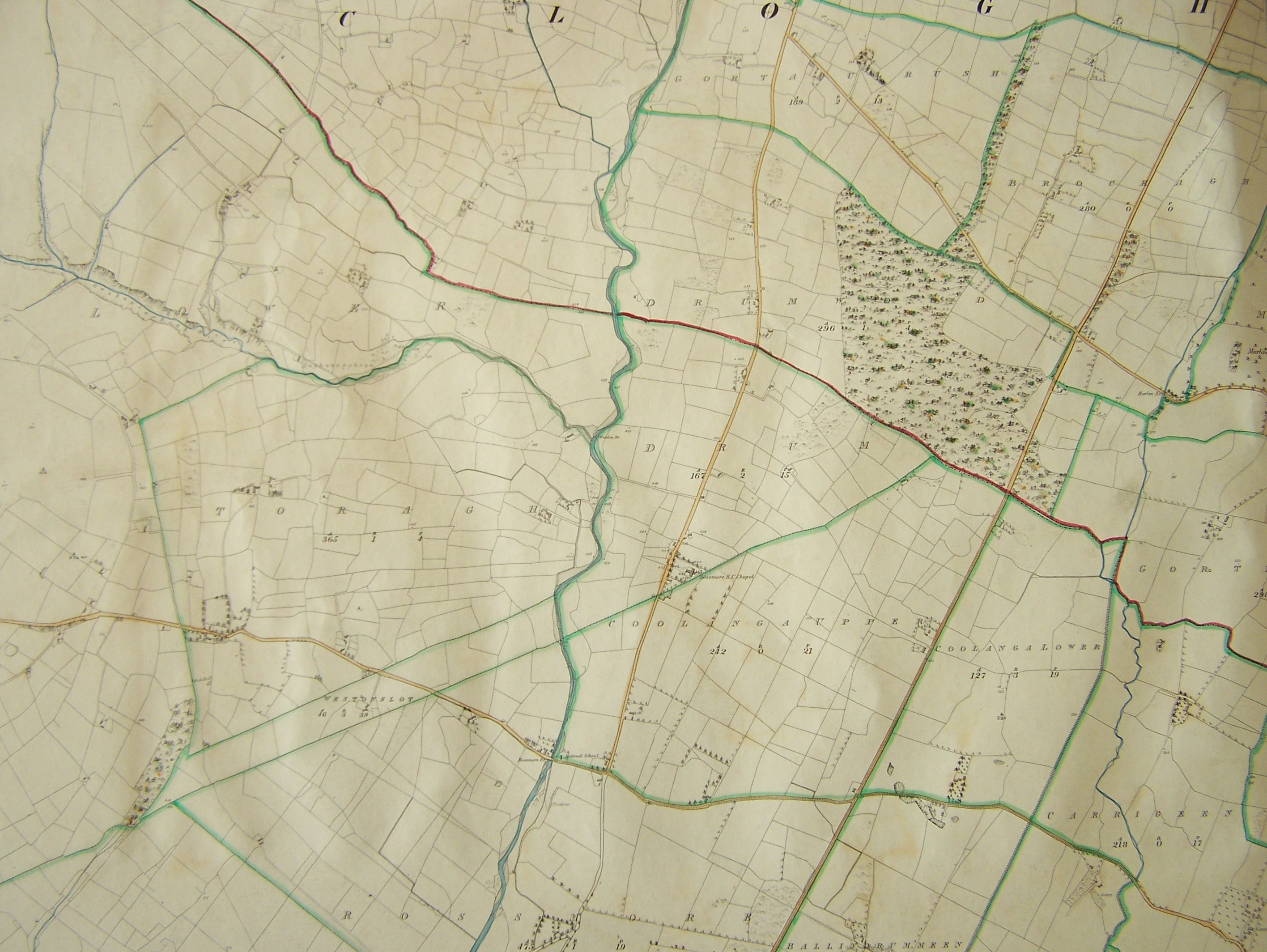 |
Map 388. In Clogher - Rossmore Cemetery in Drum, Coolanga Upper, Toragh, Drumwood, Gortaculrush, Brockagh, Coolang Lower, Carrigeen, Westonslot |
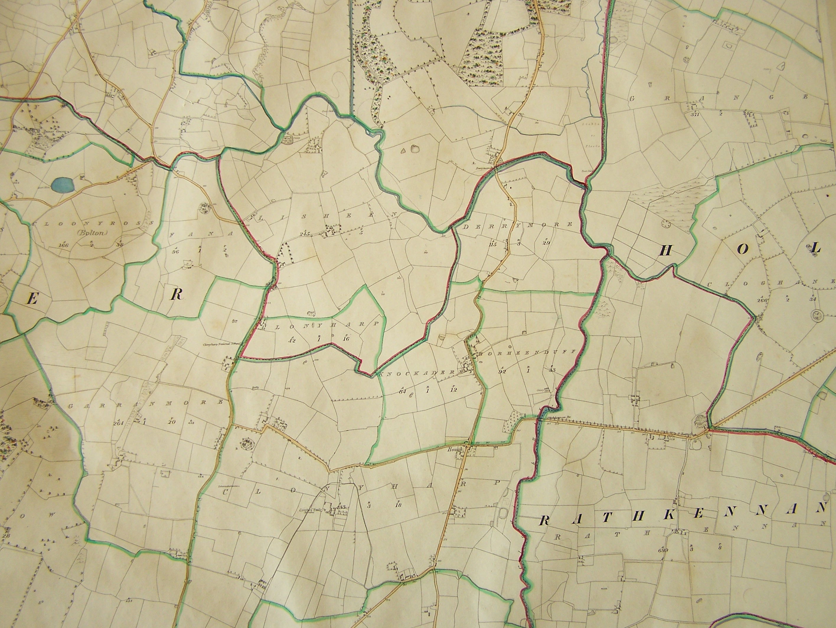 |
Map 389. In Moyaliff - Lisheen, Derrymore, part of Moyaliff. In Clogher Clonyharp, Fana, Clooneyross (Bolton), Knockaderry, Borheenduff, In Holycross - Grange and Cloghane. In Rathkennan - Rathkennan. |
 |
Map 390. Similar to Map 389 but a bit further west. Better focus |
 |
Map 391. In Moyaliff. Mostly the townland of Moyaliff |
 |
Map 392. In Moyaliff. This is the next sheet north of Map 391. This is the area north of the townland of Moyaliff and a small sliver of the northern edge of Moyaliff. In Ballycahill - A small part of the western edge of Ballycahill Parish. In Templebeg - Templebeg Cemetery in Rossmult. A little out of focus. |
 |
Map 393. In Moyaliff - Similar to Map 392 but better focus. Templebeg Cemetery cut off. |
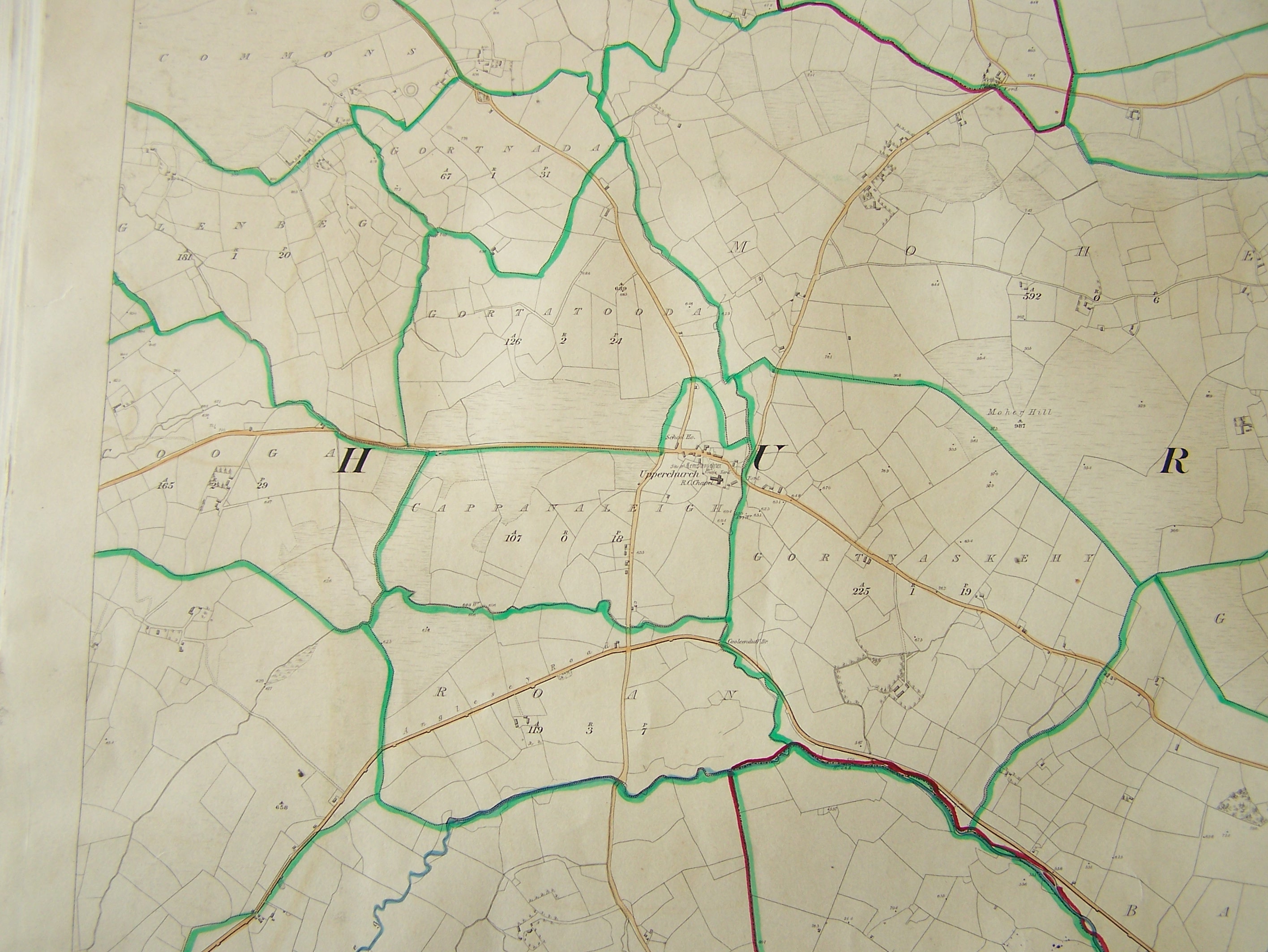 |
Map 394. In Upperchurch - Centered on Cappanaleigh townland and the village of Upperchurch |
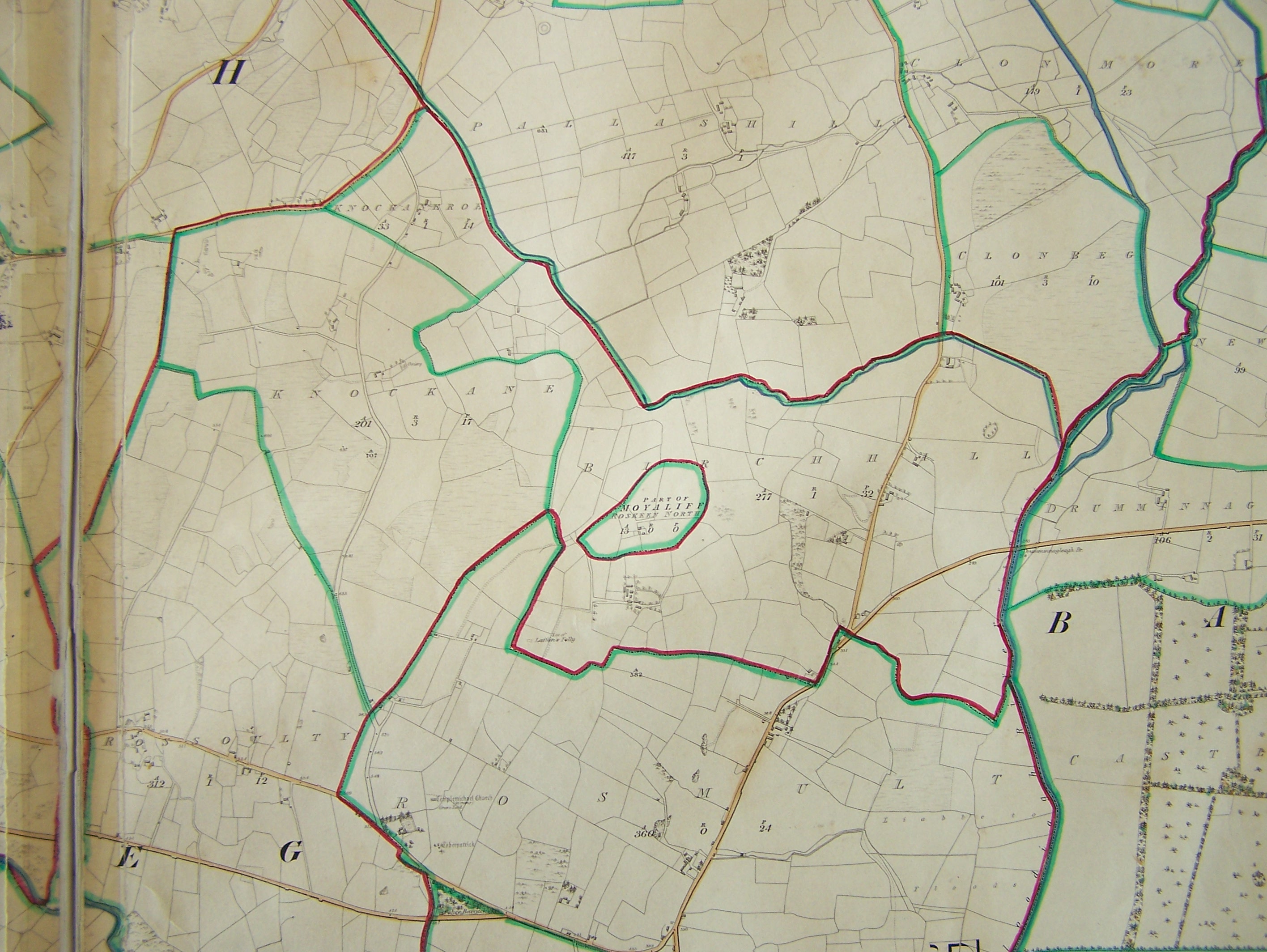 |
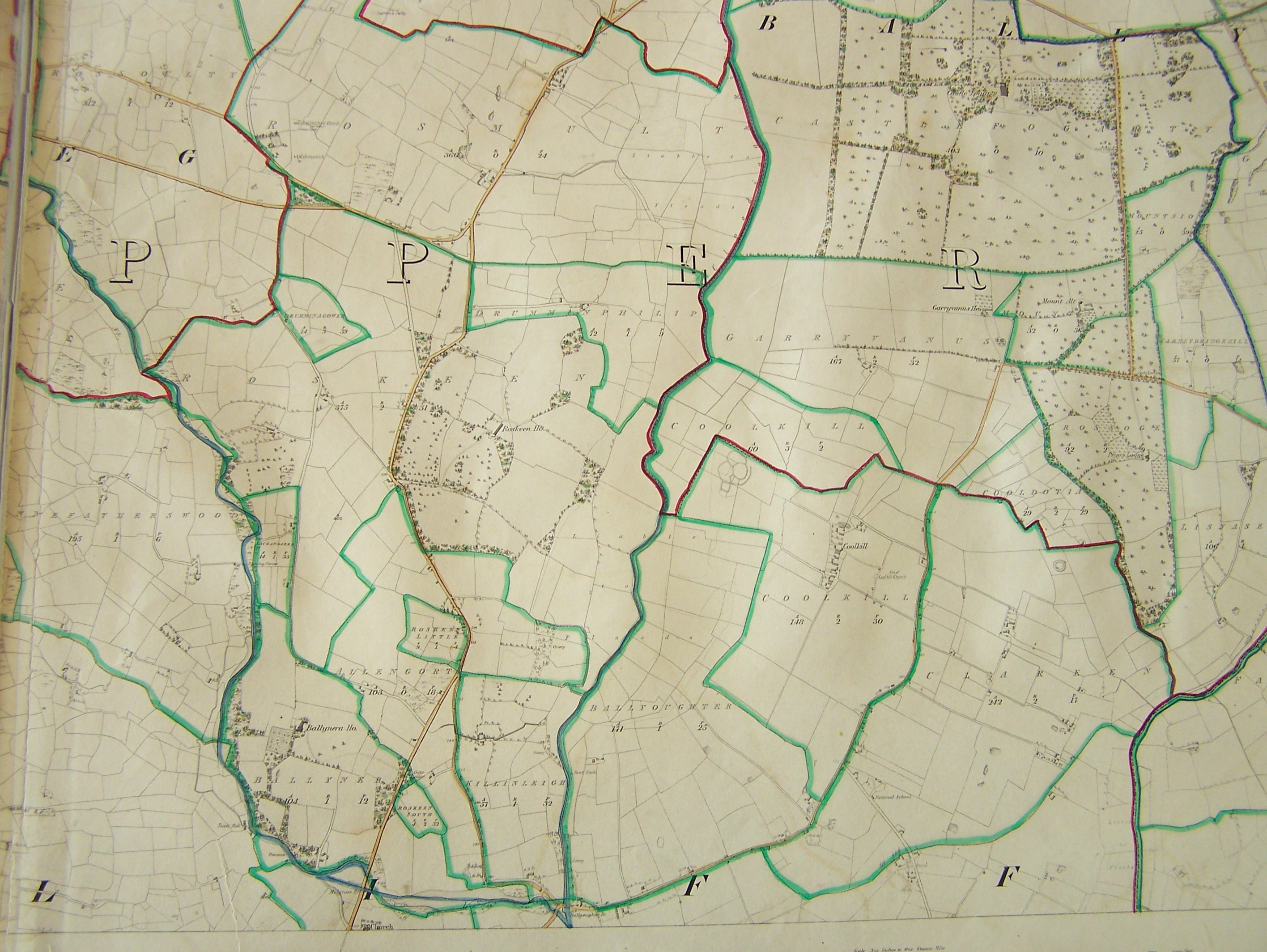
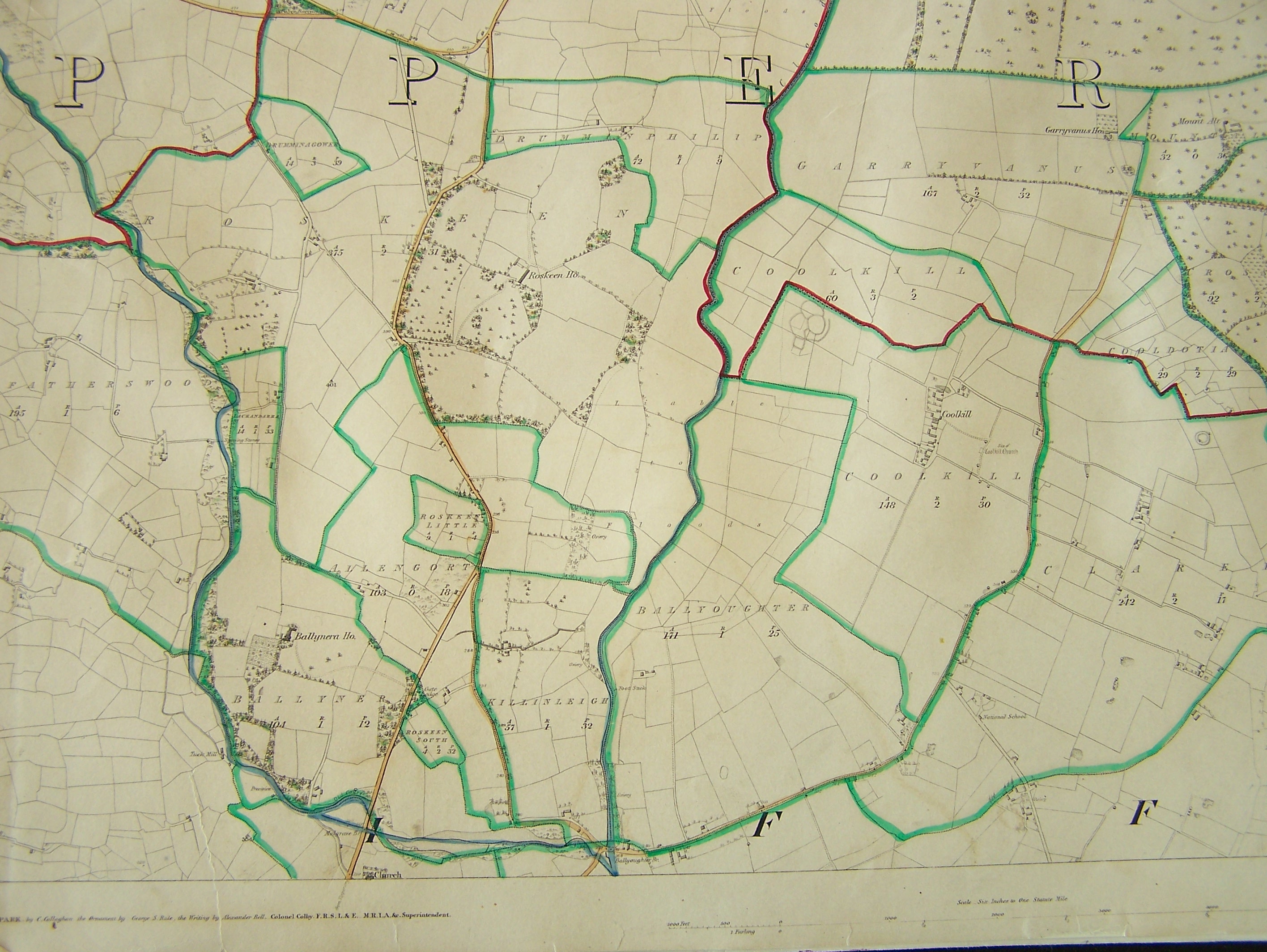
Map 395. In Templebeg - An island of Moyaliff (Roskeen North) in a sea of Upperchurch or Templebeg |
 |
Map of Upperchurch village. This is a blow up of Map 394. |
 |
Map 396. In Upperchurch - This is a slice of central Upperchurch parish just west of the village of Upperchurch. |
 |
Map 397. In Upperchurch - This is the same slice as Map 396 but a bit further south. |
 |
Map 398. In Upperchurch - This is centered on the village of Upperchurch. Similar to Map 393 but includes more of the surrounding townlands. |
 |
Map 399. In Upperchurch - This is a little south of the village of Upperchurch Map 394. |
Copyright © 2006 - Michael F. McGraw
|
Upperchurch Connections |
What's New? |
|||
|
|
||||
 |
||||