|
|
|
The Secret of the Gold Coins |

|
|
|
|
Introduction |
|
|
It’s been several years since we’ve checked in on Les Mademoiselles and they are now in their final years of high school. The problems and challenges of grade school, although seemingly insurmountable at the time, have long since become faded memories. The friendships formed during those years have remained strong. The girls continued to solve most of the mysteries that came their way, but there were always some that remained unsolvable, even for these girls. The Secret of the Gold Coins is an historical fiction story of Les Mademoiselles’ search for the buried silver left behind by the Jesuits when they abandoned their settlement at Fort Sainte Marie de Gannentaha in 1658. Along the way the girls visit old local locations and encounter many old familiar Mattydale characters, both real and fictional, some alive and others not quite alive. During the summer of 1964, Sam and Colette visited Colette’s family in Cornwall, Ontario. While in Canada they met with some of Colette’s many cousins. One of them was very interested by the fact that the girls were from Mattydale. This cousin had found a relative’s historical research which had led him to believe a group of Jesuits, who had a settlement back in the 1650s on the northeastern shore of Onondaga Lake had buried some church silver near their settlement before returning to Quebec. He didn’t know the exact location, but he knew it had been buried in a hemlock grove a short distance from the settlement. At first Colette and Sam weren’t interested in looking for the buried silver since that would involve digging — and digging meant getting dirty, which wasn’t very lady-like. The Canadian cousin reminded the girls of a mystery they had solved several years ago. He had read about it in an old newspaper clipping. It involved some gold coins found by Miles Adams on his property in 1863. The cousin thought there was a connection between the coins and the church silver. As they thought about it some more, during the long ride back to Mattydale, they began to change their minds. They rationalized that it was a mystery after all and they could always get someone else to do the digging for them. By the time they arrived back home, Colette and Sam had convinced themselves that they needed to take a shot at trying to find the treasure. After all, they thought, what if the silver was actually buried in Mattydale and they never even tried to look for it, and worse yet, someone else discovered it — right in their backyard. |
|
|
The Authors |
|
 |
 |
|
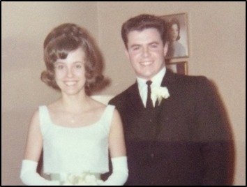
After high school their lives followed different paths. They married, raised families and later retired. After changing circumstances in both their lives, they reconnected in the summer of 2018 and began exchanging emails. As the frequency of the emails increased and Michael learned more about Colette’s old neighborhood in Syracuse, NY, he realized that this was the part that was missing in a ghost story that he had been trying unsuccessfully to get off the ground. Early in 2019 he put together a story outline and sent it to Colette, asking her to sign on as his co-author. The collaboration has worked out well with Colette preventing Mike from making the stories too historically correct and Mike preventing Colette from making the girls behave in a too age appropriate manner. This is the second book to come out of this Les Mademoiselles collaboration. |
|
|
Colette Smolinski Colette was born in Cornwall, Ontario, Canada. Her family came to the U.S. in the early ‘50s and settled in Syracuse, NY. In 1959 her family moved to Mattydale. Today she resides in Westvale, just west of Syracuse, NY. Michael McGraw Michael was born in Syracuse, NY and lived for a while in the university area. In September, 1949 his family moved to Mattydale, NY. Today he resides in Cedar Park, just north of Austin, TX. They both attended St. Margaret’s Catholic School in Mattydale and later North Syracuse Central High School.
|
|
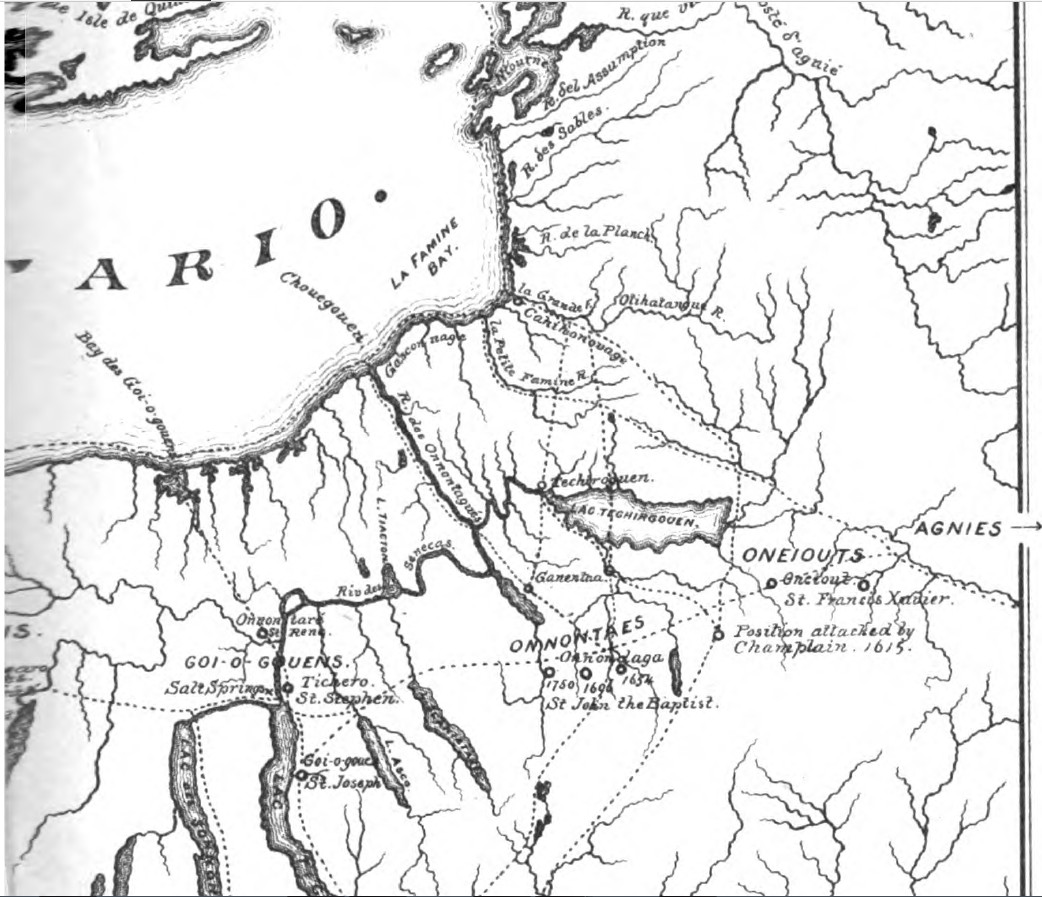
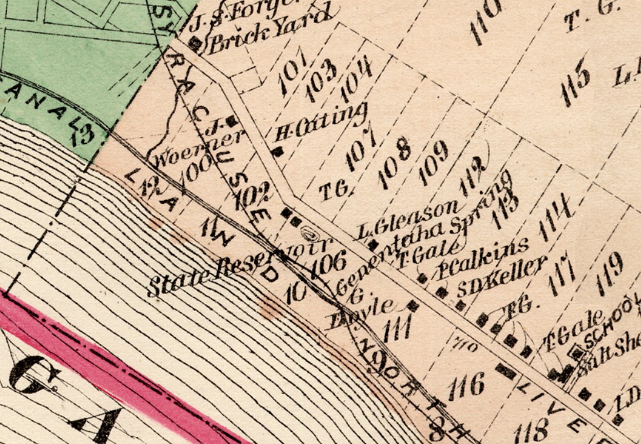
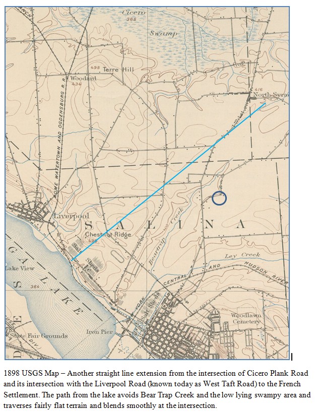
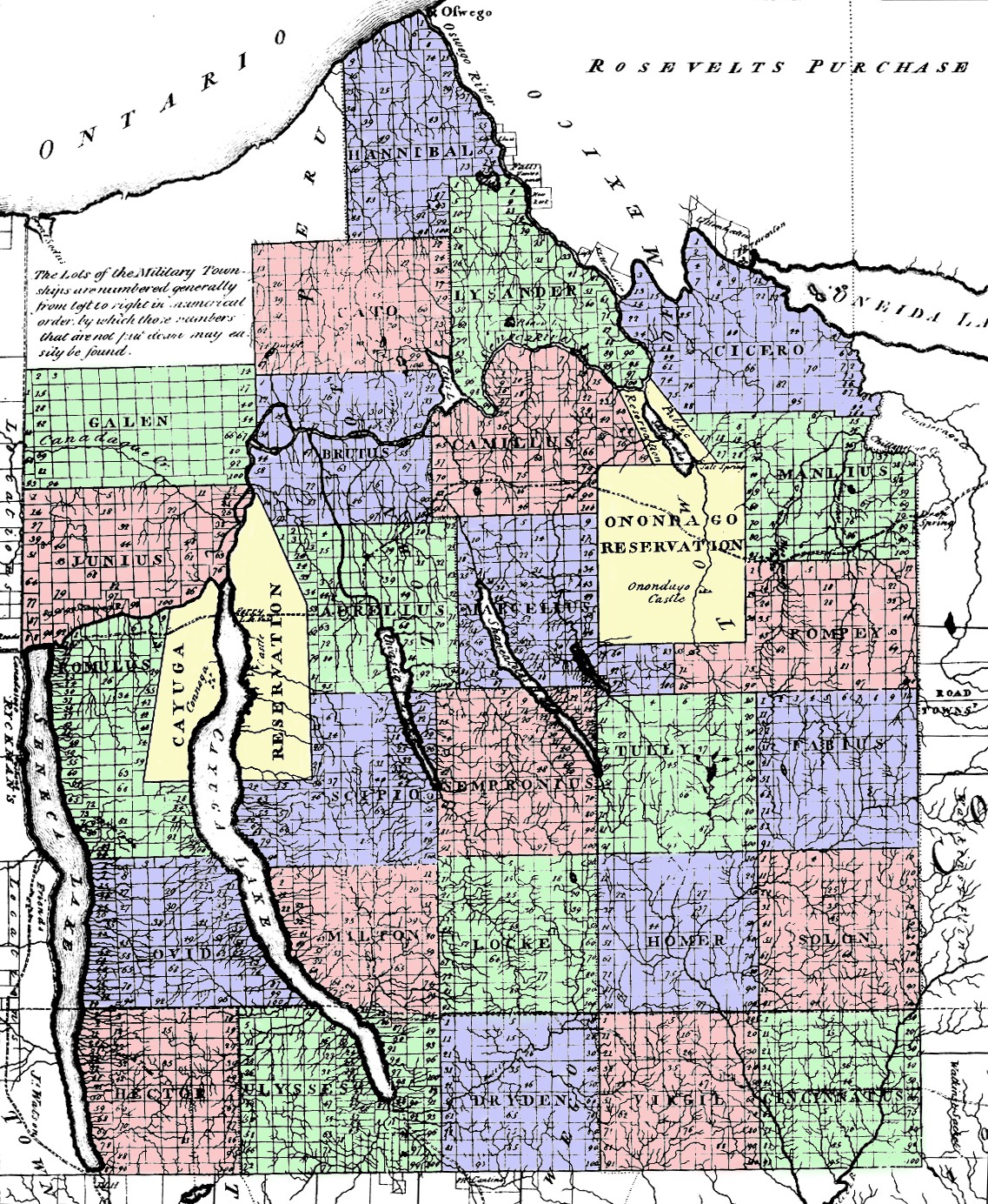
The JesuitsOld trails The village of Salina was located on the most southeastern tip of Onondaga Lake and Clark’s map above. The closest trail was one emanating from the point on the northern shore of Onondaga Lake labeled “Ganentaa”, which was the approximate location of the French settlement called Sainte Marie from 1656-1658. This trail proceeded north to the Oneida River where it exits Oneida Lake at Brewerton, NY, and from there proceeds north to La Grande River (Salmon River) where it intersects the northwesterly trail that goes to the shores of the La Famine Bay (Mexico Bay) in the southeastern corner of Lake Ontario. This intersection of the northwesterly trail is the approximate location of the modern town of Parish, NY. This map was created by Gen. John S. Clark specifically for Hawley’s 1879 book, Early Chapters of Cayuga History, Jesuit Missions in Goi-o-gouen, 1656-1684. The Jesuit Relations - These were annual reports written by Jesuits in the field to their superiors in Quebec or Montreal. The story of these annual reports can be found here. Volumes 40-44 cover the Onondagas and the French settlement on Onondaga Lake. The French Fort on Onondaga Lake. The map shows the location of the original settlement on Lot #106 just north of where the railroad crossed the Oswego Canal. Map - shows the Adams’ Grove's location relative to the French Fort. The blue circle indicates the location of Adam's Grove, which is just east of the path which the Jesuits took to reach their settlement.
|
|
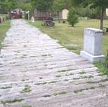
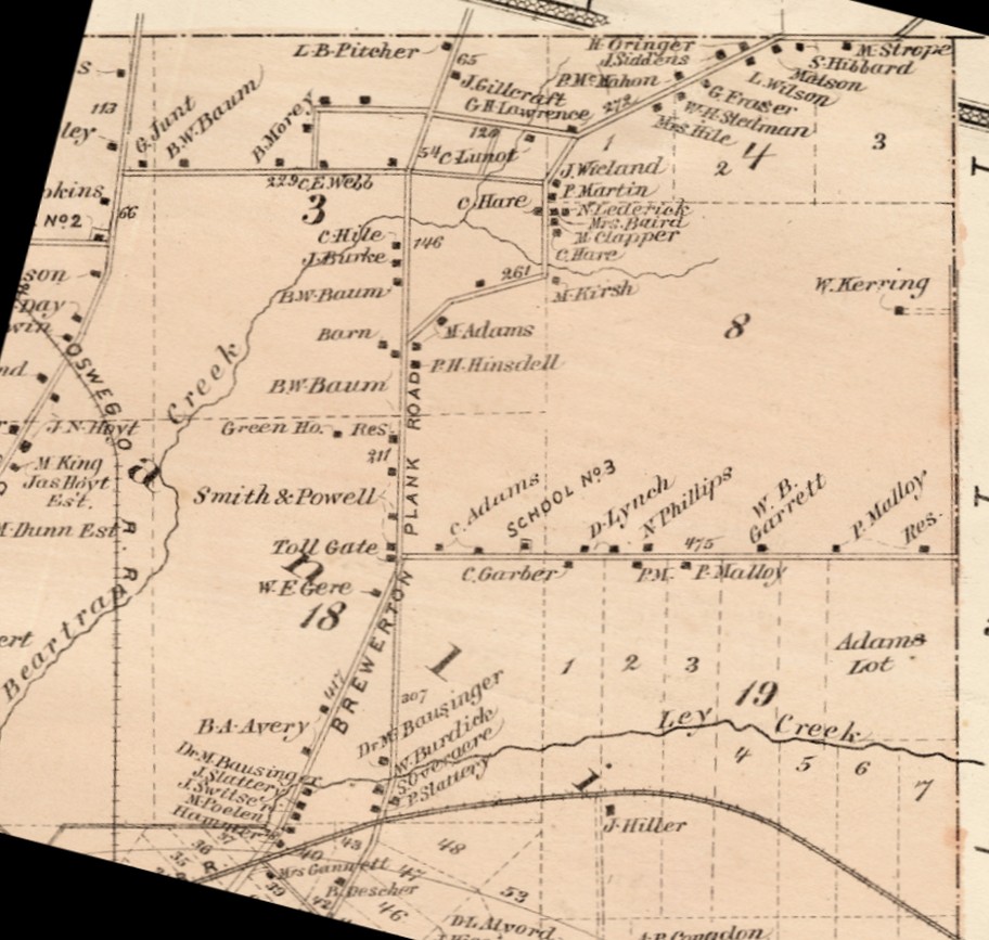
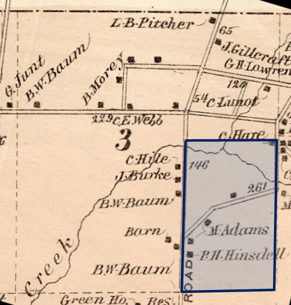
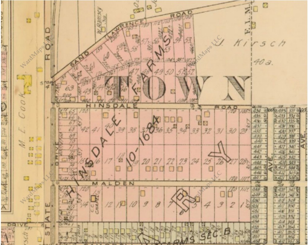
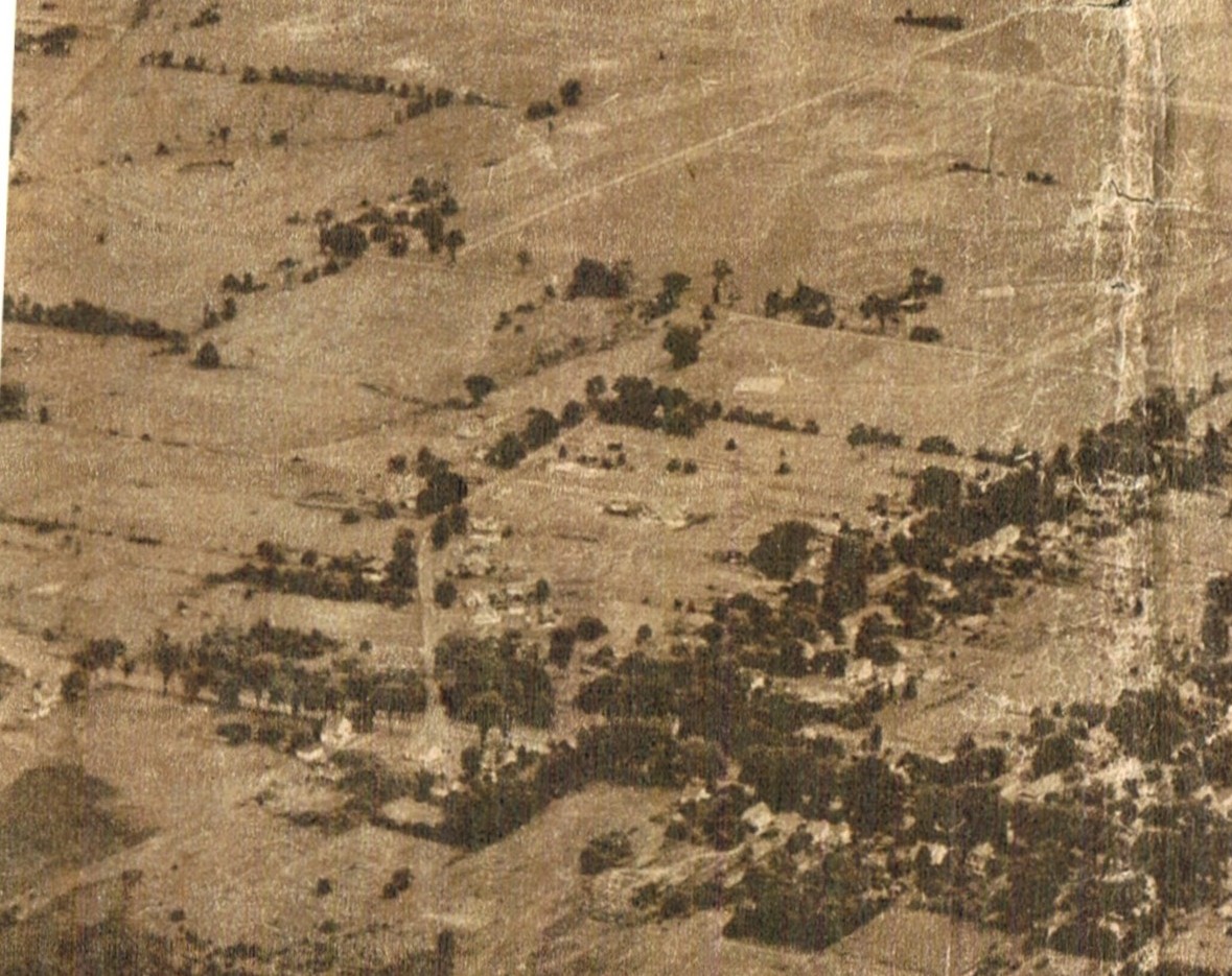
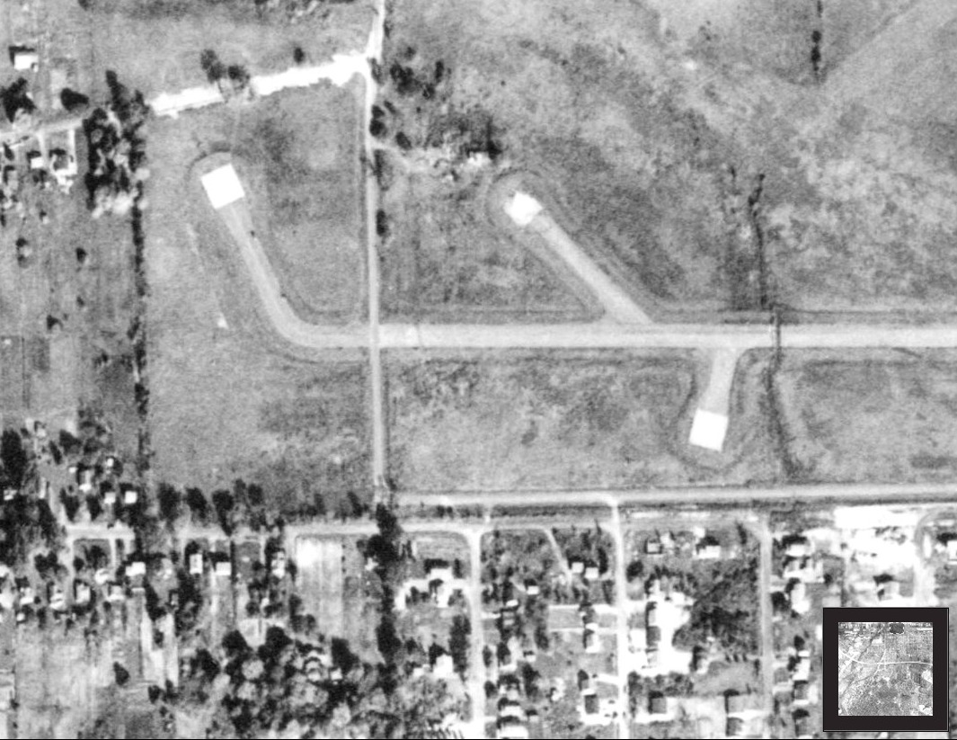
Adams’ GroveAdams' Grove Newspaper article - Describes a church outing at Adam’s Grove in 1859. The article contains a detailed description of the grove itself. 1874 Town of Salina map - From the Military Tract. The Town of Salina was taken from the northwestern corner of the old Manlius Township. Manlius was split up into the Towns of Salina and DeWitt and the original lot numbers were maintain. The area of Mattydale consists of Lots 3, 8, 18, and 19. 1874 Salina map showing the extent of Adams’ land holding. 1927 map - Sand Road area This map shows the clear area between Sand Road and Hinsdale Road, west of the dashed line, which was the former location of Adams' Grove. The Kirsch family had purchased the grove from the Hinsdell estate while it still contained the hemlock trees. Trees from the grove were used in the construction of the John Kirsch home on Brewerton Road, prior to the destruction of the grove by the 1912 tornado which struck the northern edge of Mattydale. 1948-10-17 Aerial view of former Adams' Grove This picture was copied from a 10-17-1948 newspaper and it is looking northeasterly from the southwestern corner of the airport near where Sand and Hinsdale Roads connect to Brewerton Road (Route 11). Sand Road is shown heading up from Brewerton Road and then bends to the right and proceeds to the eastern lot line of Lot #3 where it makes a left turn to the north and proceeds along the lot line. Hinsdale Road runs diagonally from ints intersection with Brewerton Road and it bordered with many trees. The barren rectangular area between sand and Hinsdale and the eastern lot line is where Adams' Grove had been located. The white rectangle in the northwest corner of the old grove is one of the hard stands that belong to the old Army Air Base. The taxiway connecting the hard stand to the rest of the runways can be seen faintly extending from the right of the hard stand.
|
|
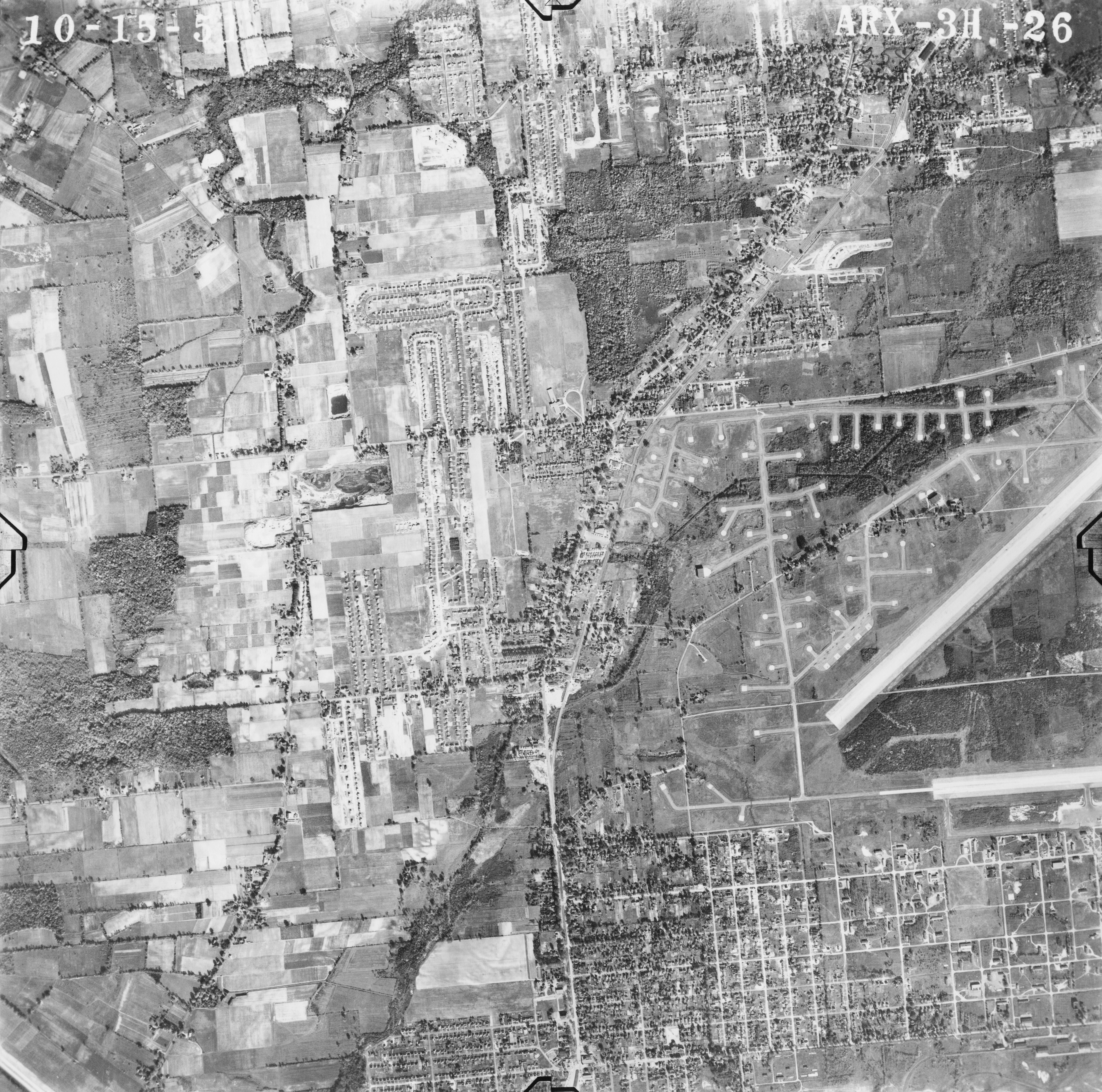
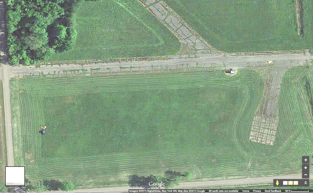
US Army Air BaseThe US Army Air Base A short story of the air base. 1951-10-15 The Hard Stands An enlarged view of three of the hard stands in the southwestern portion of the old air base. The hard stand on the left is in the middle of Adams' old hemlock grove. 1951-10-15 Aerial photo - This is an amazing high resolution aerial photo from 1951. It encompasses the west half of the airport, most of Mattydale, Pitcher Hill and the southern portion of North Syracuse. The Grooming of a Hard Stand Rather than tearing them up the airport maintenance crews continue to mow around them. The Adams' Grove Hard Stand Today
|
|
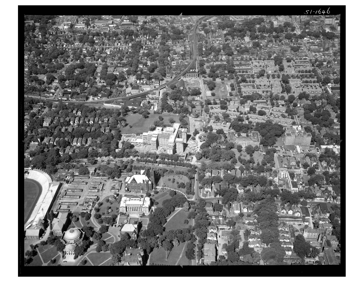
Misc.Lamson General Store pictures - 1985 and 2012 SU aerial photo - Syracuse University Campus - circa 1960 - 1962, looking west. Note the array of temporary WWII prefab buildings on the north side of Archbold stadium. These arrived in the 1945-46 school year to accommodate the influx of returning GI’s who were funded by the GI Bill. These temporary structures were still in use at least until 1966. Behind the VA Hospital (still under construction, at the top right hand corner of the picture), the open area adjacent to the hospital was the former location of Old St. Mary’s Cemetery. The final graves were removed to new St. Mary’s in Dewitt during the summer of 1958 and the spring of 1959. For the area to look that smooth this picture could have been taken as early as summer 1960. The treed areas in the upper left corner contain Sizer Street and Van Buren Street. Snaking through the picture from top center and exiting center left are railroad tracks. This was before Interstate 81 was constructed through the city.
|
|
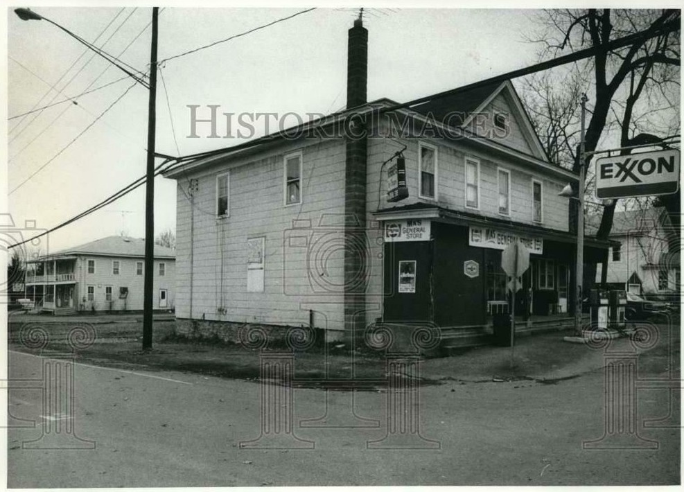
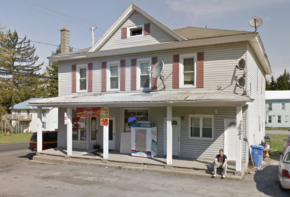
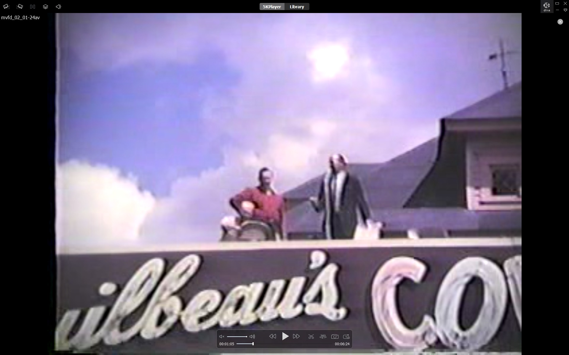
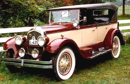
Mattydale People - LinksMatty's attic above the Color Bar 1956 MFD Parade - Matty’s attic (link to video) about 1 minute in. 1926 Chrysler Imperial - Like the one Kathie Molloy drove.
|
|