|
Military Tract Lot Lines |
|
Tracing Lot Lines Today |

|
Military Tract Lot Lines |
|
Introduction The State of New York had a large tract of land in Central New York laid out into townships and the townships in turn laid out into lots, around 1790, at the end of the Revolutionary War . The land in the tract was awarded to soldiers who had fought in the Revolutionary War. Accordingly the land was called the Military Tract. The original townships in the Military Tract were sometimes split up into smaller townships when populations were large enough. As much as possible, where it was geographically feasible, the individual lots were mostly square in shape, with east and west boundaries oriented north and south and sized at 600 acres.
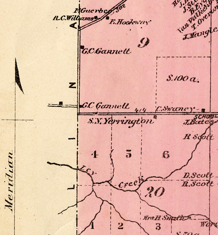
This map above is from 1792-3, it is from the first page of DeWitt’s maps. Lot 18 is labeled and Lot 3 is right above it, but is unlabeled. Bear Trap Creek can be seen to occupy much of Lot 3. These lot numbers are still found in the legal descriptions of property in the Onondaga Country deed books.
|
|
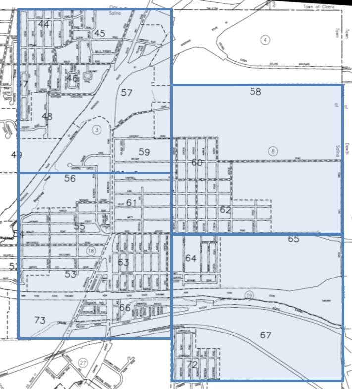
The original recipients of land in the Military Tract received whole lots and that was how these lot numbers first appeared in the land records of Onondaga County. Many lots changed hands before the owners had even set foot on their property. These lots were subsequently broken up and sold to others who eventually settled on the property. Mattydale consists of land subdivided within Lots No. 3, 8, 18 and 19, in accordance with discernable subdivision plans. (See: "Original Lot Owners: Salina 3, 8, 18, 19") These original Lot No. designations are still used and are found in the legal descriptions of property being bought and sold today. The Town of Salina Tax Map has an overlay that shows these Military Tract Lots.
One of the requirements placed upon the owners of land in the Military Tract was that a certain amount of land needed to be used in the construction of roads. Often these roads were constructed along the lot boundaries.
|
|
This section of the 1874 Town of DeWitt Lot map (pink) shows the eastern boundary of the Town of Salina. The road running east-west along the center of the map is known as East Molloy Road today. As it passes from the Town of DeWitt to the Town of Salina it makes a sharp right angle turn to the north followed by a quick right angle turn to the west. In DeWitt the road runs along the boundary between Lots 9 (north) and 20 (south) and in Salina it runs along the boundary between Lots 8 (north) and 19 (south).
|
|
For many years this double dog-leg existed in East Molloy Road as it crossed Townline Road. For some reason, probably related to some difficulty in the original layout of the Military Tract in the 1790s, the common boundary of Lots 8 & 19 didn’t match up with the common boundary of Lots 9 & 20, hence the double jog. In later years this was smoothed out to make a more graceful and safer crossing of Townline Road.
In many places the roads follows the boundary lines of the original Military Tract Lots. Townline Road which runs north and south (see above map), follows the East Lines of Military Lots 8 and 19 (town of Salina) and this coincides with the West Lines of Military Lots 9 and 20 (town of DeWitt).
East Molloy Road (Richmond Road) from just east of the school to Townline Road is the boundary between Military Lot 8 on the north and Military Lot 19 on the south.
|
|
The Military Lots 3 and 18 are seen on this 1860 map of the town of Salina.
|
|
Other Military Lot Line boundaries are marked by physical
objects but they are a bit more difficult to discover.
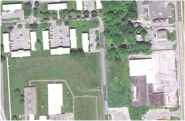
The boundary between the Roxboro School property and the Orchard Estates property is the South Line of Lot 3 on the north and the North Line of Lot 18 on the south. The aerial image below (2014), covers an area in the 1874 map above, approximately equal in size to the "H" in "T S & H", near the intersection of the Lot 3-Lot 18 boundary with the Cicero Plank Road.
|
|
2014 - On the left side of this aerial image are the Orchard Estate Apartments at the top and Roxboro Elementary School at the bottom. Roxboro Road runs north & south, up the middle of the image and the southbound lane of Brewerton Road can be seen along the right hand side (east) of the image. The building in the lower right hand corner is the Action Sport and Skate.
|
|
The beginnings of the Lot 3 - Lot 18 boundary line can be seen on the right as a row of trees along the northern boundary of the Action Sport and Skate property. The Action Sport and Skate property was the location of Rose Lawn, the childhood home of L. Frank Baum, author of the Wizard of Oz. The boundary line in the 1950s and 1960s was marked by a continuous row of trees. Today there are a few trees and a chain link fence to mark the boundary between the Orchard Estates apartments and the Roxboro schools.
|

