|
Tornado Damage Map |
|
|

|
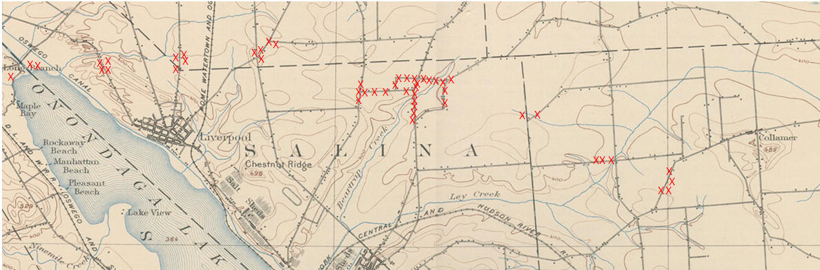
Tornado Damage Map
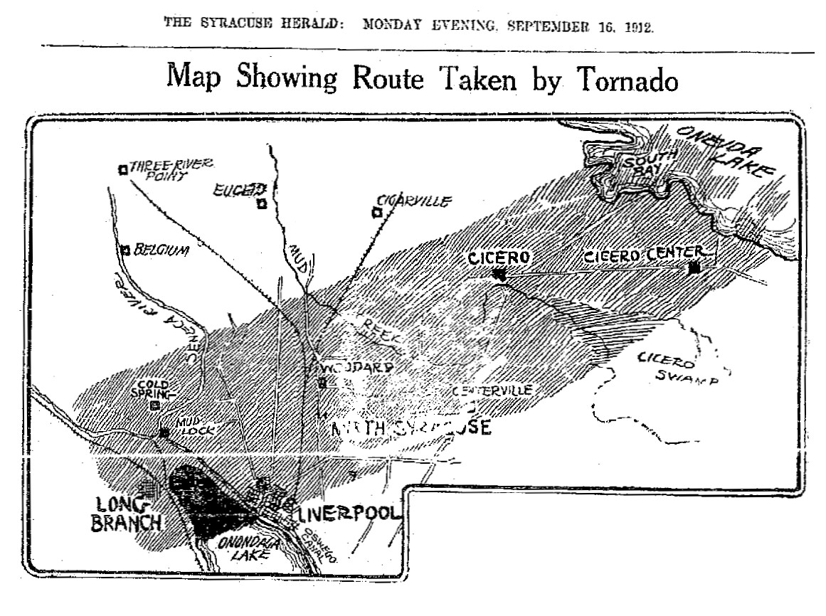
This map shows the location of the various victims of the 1912 tornado as reported in the Syracuse newspapers of that time: The Journal, The Herald and the Post Standard. The map is the upper portion of the USGS map published in 1897, based on a 1893 survey. It was chosen because it accurately displays the major roads that were in existence at the time of the 1912 tornado. All of the properties that were damaged and were described in sufficient detail, so that they could be placed geographically, are indicated on this map by red "X"s. The path of the tornado is easily seen to be easterly after Long Branch and then slightly southeast as it headed for Pitcher Hill. The Syracuse Herald published a map that incorrectly showed the direction to be northerly and grossly exaggerated the width of the path.
There are several changes that have occurred over the years in names and locations that need to be addressed. The original Long Branch was an amusement park that was located on the south side of the present day outlet on Onondaga Lake. The Oswego Canal is shown on this map but by 1912 it had been replaced by the lake outlet and the locks on the Seneca River. The old canal was filled in and it became the Liverpool Parkway. The present day Long Branch is a picnic area and it is still located on the western end of the lake, on the north side of the outlet.
There are eight groupings of tornado damage and they will be described moving west to east. The second group, Long Branch being the first, occurred on Cold Springs Road (Route 370), the Road to Baldwinsville. The third group is on Morgan Road, which is also referred to as the Phoenix Road or Clay Corners Road, because it leads to Clay Corners, which was later known as Euclid, on Route 31. The fourth group is at the intersection of 7th North Street and Bear Road. Today this is West Taft Road (Bear) and 7th North Street is Henry Clay Blvd, to the north and also Henry Clay Blvd., to the south, to Hopkins Road where it becomes Electronics Parkway. A bit northeast of this intersection, intersecting Bear Road from the east, is Dunham Road, it was later Fay Road and then West Taft Road. The fifth group is where most of the damage occurred. The first north south road in this group is Buckley Road (Greenpoint Road). Bailey Road intersects Buckley from the east. At the other end of Bailey Road is the Cicero Plank Road, which was enjoying its final days. Branching north off Bailey Road is Elbow Road which becomes Lawrence Road as it crosses the plank road. Sand Road intersects Lawrence Road from the south and terminates at the other end at Cicero Plank Road. The sixth group is the intersection of Townline Road (north-south) and Temple Road which branches off Townline Road to the northeast. This location is today under a runway of Hancock Airport. The seventh group is on East Molloy Road (Old Gannett Road), just west of the intersection with Thompson Road (north-south). The eighth and last group is on what is now the Old Collamer Road. At that time it was the Collamer State Road, which had been the old Bridgeport Plank Road. |
|