 |
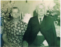
John and Mary Smith Kirsch on the occasion of their 55th
wedding anniversary in 1945 |
 |
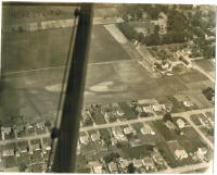
An aerial view of the John Kirsch homestead. Kirsch Drive
is the street running horizontally along the bottom of the picture. |
 |
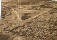
Aerial photo of Mattydale from the October 17, 1948
edition of the Post Standard. In the foreground the picture extends from
Sand Road on the left down past Molloy Road on the right. The Kirsch
homestead and barns and St. Margaret's Church can be made out. At the
intersection of Molloy and Brewerton the new McKinley Supermarket can be
seen crowding out Frank Matty's old house. Further up E. Molloy Road the
Mattydale Volunteer Fire Department and old Mattydale School are easily
spotted. |


