|
New Tornado Pictures |
|
Lavont Charles Allen |

|
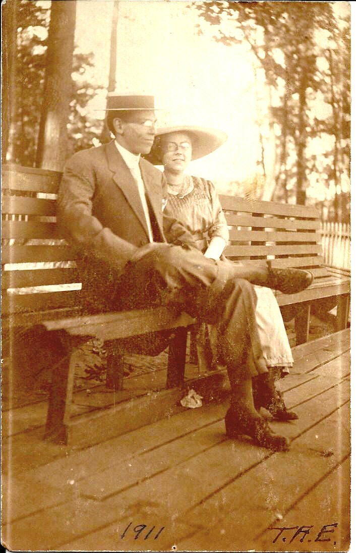
Lavont Charles AllenJune 10, 1888 – January 1, 1972
The son of Frederick W. Allen and Genevieve Chandler, Lavont Allen was born in Cicero, NY. Al was an engineer who worked for Lamson Corp. and over his career he was credited with creating many inventions for them and he held a few patents. Allen also loved building things and was fascinated by architecture. On the inside cover of his album it reads, "Photographs 1911 – 1948." It contains some family photos, mostly of him and his wife or his wife with friends. However, the majority of the photos are bridges, buildings, pieces of buildings or a specific detail he liked. And of course there are the tornado photos.
The photo on the left is a picture of Lavont and his future wife, Margaret Ethel Bartlett taken in 1911.
These pictures were provided by Robert Steingraber, Allen's step-grandson.
|
|
|
|
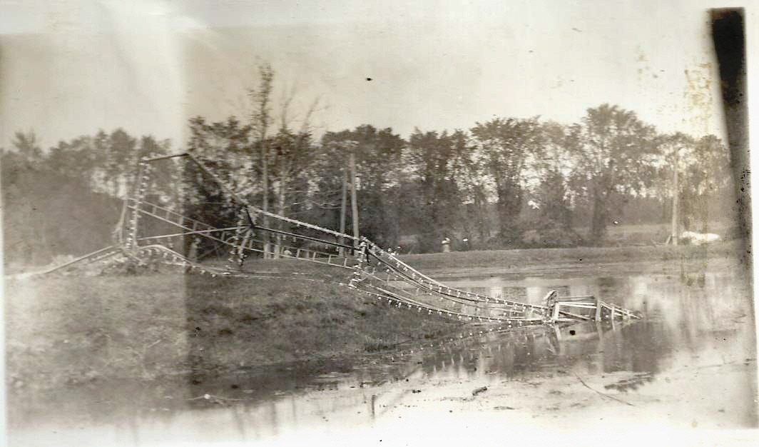
Long Branch This appears to be a tall tower covered with electric lights. In the several postcards showing the entrance to Long Branch Amusement Park no such structure can be seen. However, it existed in the vicinity of the park even though its exact function has not been determined. |
|
|
Long Branch The structure seen on the left side of this picture appears to be a potion of a roof. The octagonal shaped structure might have been a cupola on the building whose roof is shown to the left. |
|
|
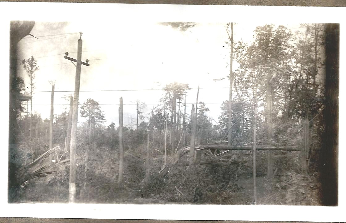
Originally referred to as #9. Could this be one of the house pictures and not be at Long Branch at all? The density of the downed trees makes this seem like a Long Branch location. |
|
|
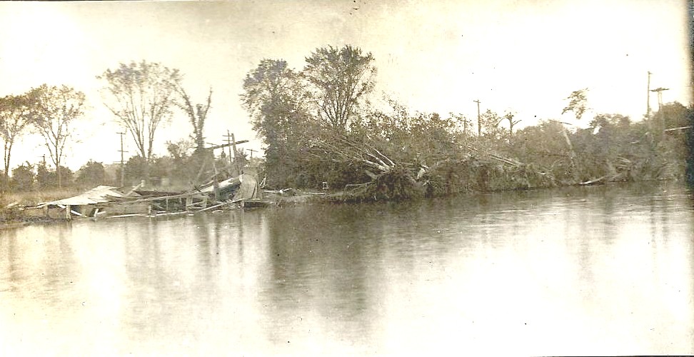
Long Branch This doesn't seem to be a picture of the amusement park. It might be the dock and boat houses across the outlet from the park. Huge trees can be seen to have been pulled up with their roots exposed. There appears to be ruins of a dock and boat houses along the shore. |
|
|
Long Branch This shows a low lying grove area near the amusement park. The low level of the land had caused the trees to be broken off, high up, rather than being pulled from the ground, roots and all. In the lower left hand corner of the picture several people can be seen walking among the downed trees. Their relative sizes compared to the trees helps establish the large size of the trees. |
|
|
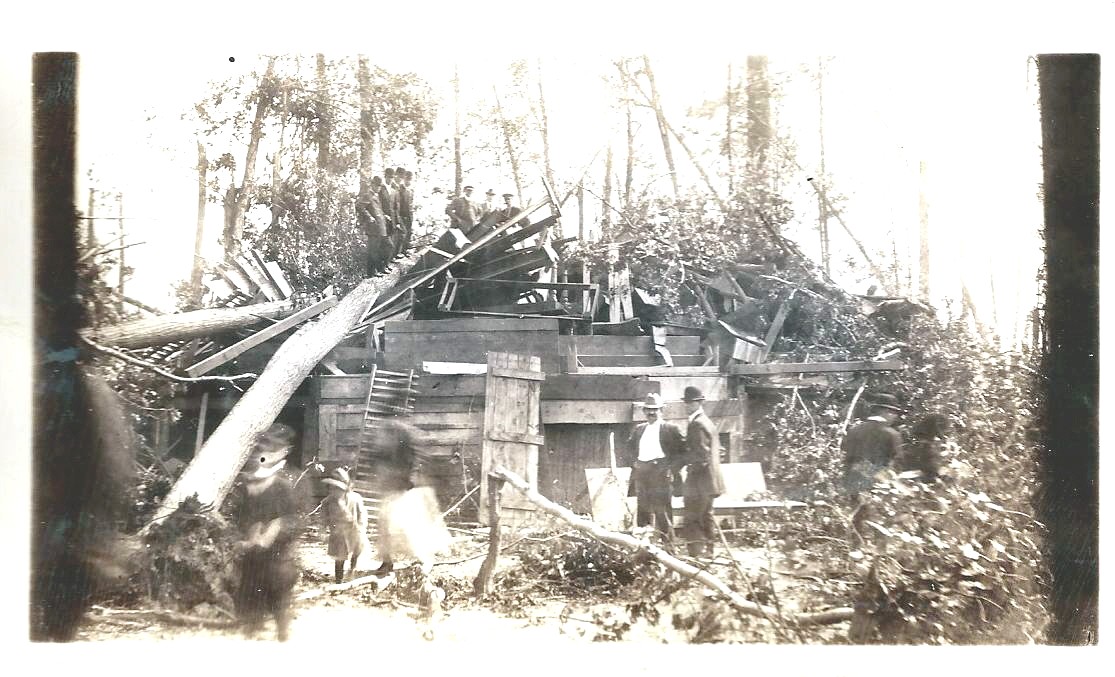
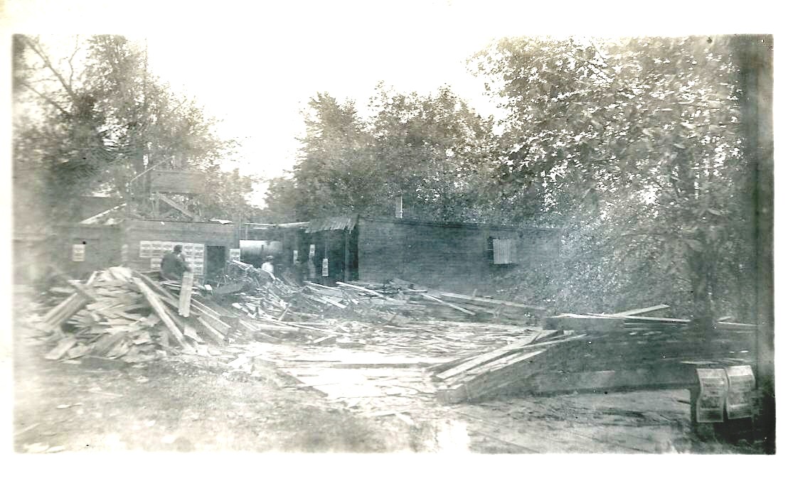
Long Branch This appears to be one of the buildings that were part of the amusement park. The orderliness of the wood piles would seem to indicate that some cleanup effort was underway. There are posters on the wall of the building on the left. Unfortunately the resolution isn't good enough to allow them to be readable. The same is true of the two posters in the foreground in the lower right hand corner of the picture. |
|
|
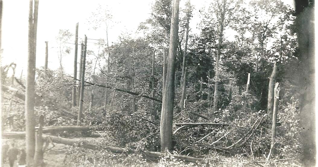
Long Branch Here is evidence that the poles bringing electric power, telephone and telegraph services to the amusement park area were not all destroyed. In the lower center of the picture is a tree that appears to have been twisted and then been over. The lower portion of three trunk has been shredded. |
|
|
Long Branch The presence of all the trees in this picture makes it seem that this was taken in the amusement park area. The large structure on the left appears to be a portion of a roof. Click on the picture to see an enlarged version and an American flag can be seen in the background. There are also the striped canvas tops of two tents in the background. |
|
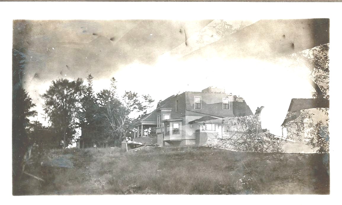
There is a good chance that this house belonged to Arlie W. Richardson and it was being rented by Frank Crosby at the time of the tornado. It was located on the east side of the Plank Road, at the top of Pitcher Hill, across the road from Henry Morey's brick house. This view is slightly toward the northeast. Check the description of the damage to Frank Crosby's home
|
The right hand side of the picture appears to be doubly exposed. The ominous looking clouds might also be the result of this double exposure. Enlarging the picture another house can be made out in the distance, among the trees on the left. The third structure, seen on the right, might be part of the double exposure. |
|
Charles Chapman House ?
|
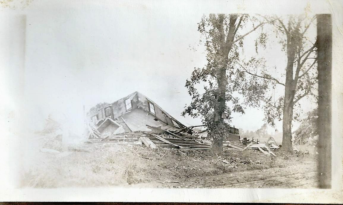
This house has been totally destroyed but amazingly the two trees next to the ruins don't appear to have sustained much damage. There is a road passing along in front of the house which can be seen in the lower right hand corner of the picture. Between the two trees there appears to be a cylindrical shaped mailbox that is still standing. This is possibly the Charles Chapman House |
|
Henry Morey House
It has been determined that the house in the distance is the old Charles Bailey house in Pitcher. It was located on the northwest corner of the intersection of Bailey Road and the old Cicero Plank Road. At the time of the tornado the house was owned by a member of the Morey family. The road in the foreground is the Cicero Plank Road and the camera direction is approximately southwest. Another picture of this house, from the 1930s, taken from the south is found here.
|
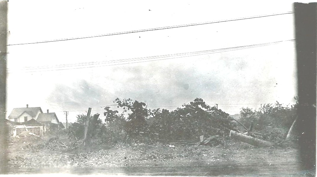
The house in the distance, in the center of this picture seems to have escaped unscathed. Along the right side of the road a couple dozen sawed trees trunks can be seen. The cleanup seems to be well underway at the time of this photo. Behind the main house is a smaller, open air structure that consisted of just a roof. The tornado must have passed out front, where al the trees were downed. This weak structure would have disappeared if the tornado had moved through the back end of the lot. |
|
Based on the fact that the other houses pictures in Lavont Allen's collection were taken in Pitcher Hill, it is assumed that this picture is also from Pitcher Hill. The identity of the house on the left has not been determined. There is a road, probably the Cicero Plank road, in the foreground and the telephone lines above are still in place.
|
|
|
This had been determined to be William Michaels' barn. It was located just south of Pitcher Hill, on the west side of the Cicero Plank Road approximately across from Sand Road. Compare the above picture to the newspaper picture of Michaels' barn
|
|
|
|
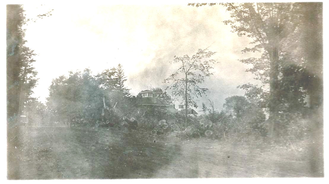
The location of this picture has not been determined. The small number of trees in the immediate area suggests that this picture was taken in the Pitcher Hill area. Long Branch was in a grove of trees and those pictures always have many trees, either vertical or horizontal. |


