| Mattydale Landmarks |
|
Visible, Hidden or Just Forgotten |

|
Mattydale Landmarks |
|
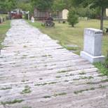
Introduction Landmarks are everywhere, you just need to know where to look and to understand what it is that you are looking at. Now these are local landmarks that only the local residents of Mattydale will appreciate so don't expect the tour busses to show up any time soon. This list contains the descriptions of landmarks that are still is existence and some that are long gone.
|
|
In 1806 Mr. Elisha Alvord laid out the new State Road that became known as the Salt Road. [1897-10-28] It opened in 1812 and started at the center of Salina village, at a point known today as Washington Square, and followed Center Street north, out of the village. At 5th North Street, the State Road branched off to the right and continued north, across Ley Creek, through what would become Mattydale, up Pitcher Hill and on to Centerville (North Syracuse) and ultimately reaching Oswego and Watertown. Today it is known as Lemoyne Ave over most of its extent. Over the years its pathway was moved west and it was enlarged. Parts of the old road are still visible in Mattydale and are named LeMoyne Street. |
|
The land in the Military Tract was awarded to soldiers who had fought in the Revolutionary War. One of the requirements placed upon the owners of land in the Military Tract was that a certain amount of land needed to be used in the construction of roads. Often these roads were constructed along the lot boundaries which makes them easy to find today. Other boundaries are also marked by physical objects but it takes a little more work to find them.
|
|
Cicero Plank Road Toll Gate No. 1
After the turn of the century people were becoming annoyed by the tolls charged on the privately owned Cicero Plank Road. Another private company, owning a road between Cicero and Brewerton, tried to get an extension of their charter but the Legislature turned them down. In 1913, Onondaga County bought the plank road from the company but the company retained ownership of the tollgate buildings. Tollgate No. 1 was located at the northwest corner of the intersection of Brewerton Road and Molloy Road.
|
|
The Lost Bear Trap Creek Tributary
There was a story about a tributary of Bear Trap Creek that was located behind the future location of the Hollywood theater. According to the story, it had been filled in 1927 when the Kirsch Farm was being prepared for residential development.
|
|
The Duplessis History of Mattydale had a little to say about this: "At one time there was only one store. It was more or less a small shack operated by an Italian named Pete. This was located a little southeast of the intersection of the Molloy Highway and the Brewerton Plank Road. This shack burned. The site is now occupied by the Red and White Store."
|
|
Frank Buchanan died at age 68 at his home on Brewerton Road, Trolley Stop 3, on June 22, 1930. During the time period 1930 to 1948 the southern portion of the Buchanan property, became known as Buchanan Field and was used for sporting events, veterans' field days and even the James Strate's Shows set up there in July 1947.
|
|
The Cicero Plank Road had lasted 67 years but the trolley was gone in 23. It had been running parallel to its competitor and eventual successor for most of that time. After the Cicero plank road was re-opened in 1915, as Brewerton Road, a modern highway, and the number of automobiles exploded, the trolley was on borrowed time. The Trolley was discontinued as the Great Depression began, even as the population explosion in Mattydale was continuing - at least for a while. The final Trolley run came on Monday night, January 11, 1932.
|
|
The Army Air Base was built in 1942. After the war it became Hancock Airport and was expanded in the 1960s to become Hancock International Airport. The evolution of the commercial airport was not a hasty process, but like the original air base construction, remnants of the previous occupant were left untouched. Many of the concrete pads, used for storing planes and the auxiliary runways connecting the pads around the old Army Air Base are still visible today. |
|
The Salina Free Library has had four homes over the years since its first opening on January 16, 1942, in an old gas station at the corner of LeMoyne Avenue and Boulevard Street. During the 1950s its second home was located in a small house at 105 West Molloy Road. In 1947 the John Kirsch family donated land at 105 West Molloy. |
|
In September, 1931, Mattydale School was bursting at its seams as a result of all the residential development taking place around it. Over 1,000 students had been recorded at the school that was only eight years old and had been expanded in 1928 by adding two wings, only three years before. However, the Great Depression set it and the growth stopped. The school district had purchased land west of Brewerton Road for an elementary school but it was never built. However they kept the land.
|
|
Around 1949 a section of Brewerton Road was realigned and left the residences and businesses from West Molloy Road to Garden City Drive with their own private road. Articles published at that time related the realignment with the construction of the Thruway, but that doesn't hold up. |
|
In the 1952-53 time frame the remainder of the Kirsch farm, north of Kirsch Drive, had been sold to the North Syracuse Central School District. The land was intended for the construction of new schools as the battle to stay ahead of the growing Baby Boom continued. In the Spring of 1953 a group of volunteers, led by Johnny Angelo and supported by donations of materials, began the construction of a baseball park. The school district had allowed the group to use the far southwestern corner of the property for the park, until it was needed for school construction. The Roxboro Road Middle School that eventually occupied the site wasn't completed unit July 1959. It was a good run - 6 seasons - ending with the 1958 season.
|
|
The Mattydale School Maple Trees
There were 11 maple trees that were planted in front of the Mattydale Elementary School in 1945 to commemorate the 11 former students at the school who had lost their lives in World War II. The trees are dwindling in number and only a couple remain.
|
|
Four sets of old aerial photos have been found that cover all or parts of Mattydale. They are from the years 1926, 1938, 1951 and 1966. These maps have been used through out the construction of this site. In this case several map selections from this set are used to label the various landmarks around Mattydale.
|
|
NOTES: [1897-10-28] - "The Last Tribute, The Rev. Mr. Fahnestock Recalls the Busy Life of Mr. Alvord," The Syracuse Daily Journal, Thursday, October 28, 1897.
|